
Planning to visit Laguna Chicabal? We’ve got you covered!

The water of the sacred lake rippled as calls of exaltation carried across it.
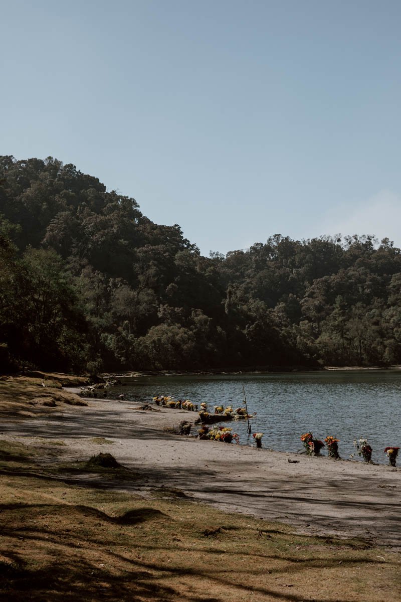
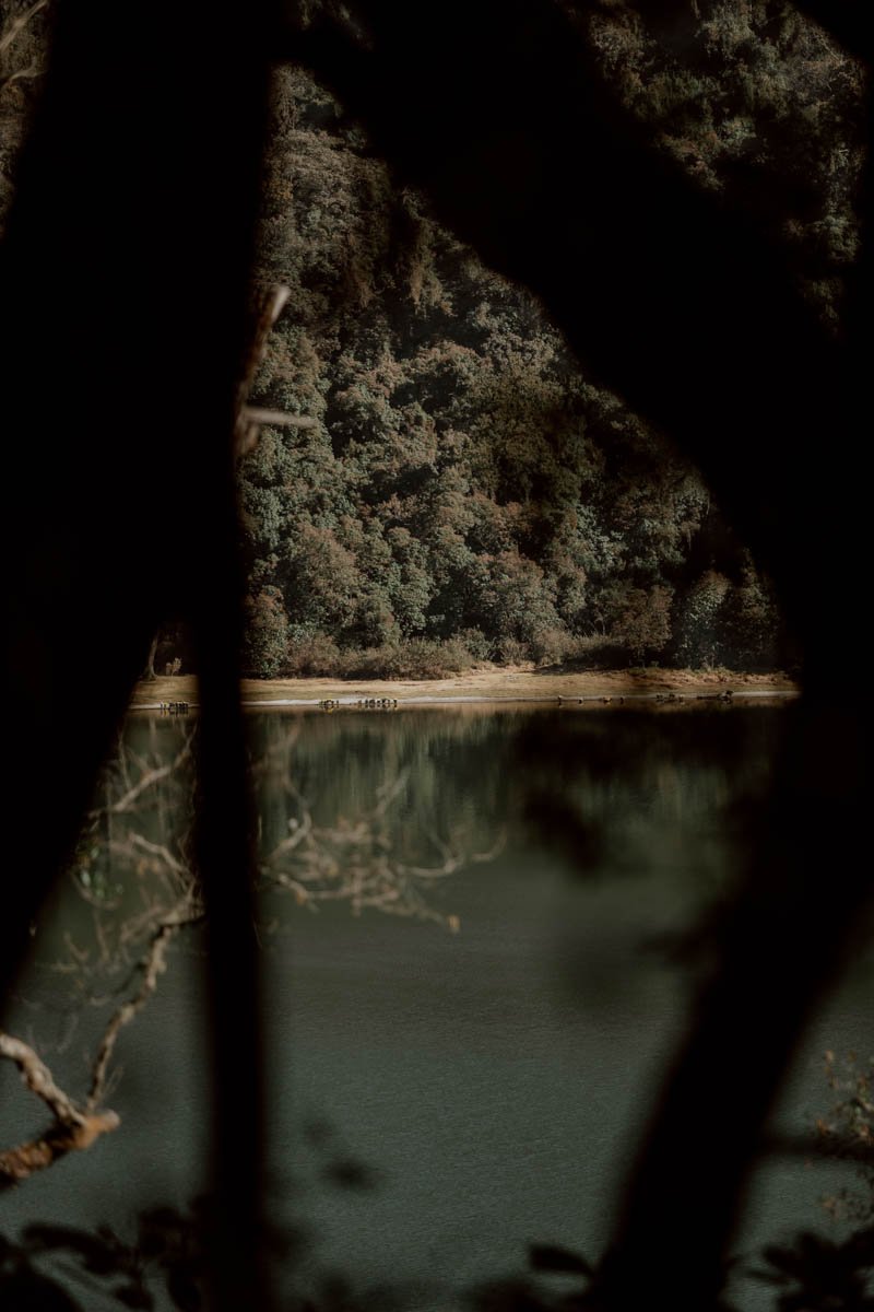
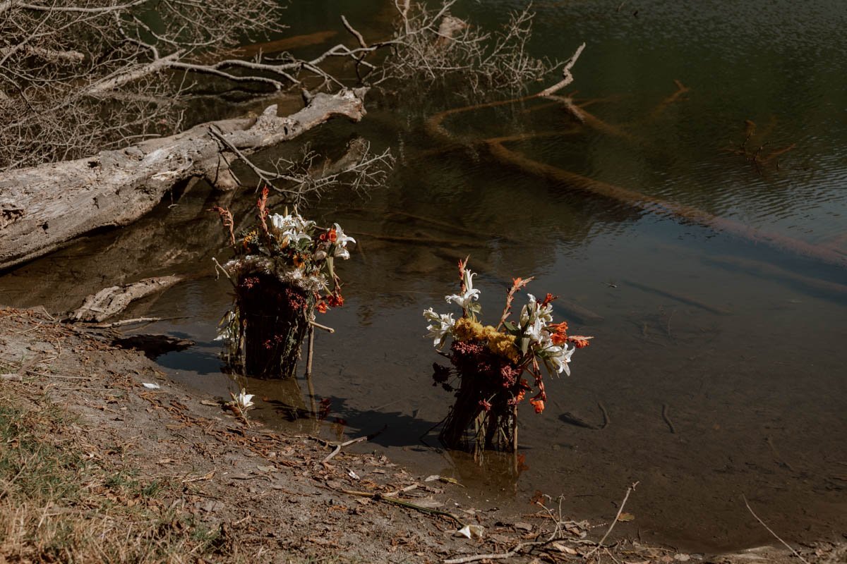
On the circular shores lay bouquets of flowers fresh, drying, and decaying. The scorched remains of altars scarred the grassy banks. Between the reeds and trees, graves marked by handmade crucifixes revealed themselves.
Across the lake, the dozen or so women and a handful of boys continued to wail and cry in unison. Echoing within the crater, their sound was like no other: a pleading, guttural mix of grief, joy, angst, and hope.
We realised that this was what true faith in someone, something, or somewhere sounded like.
-
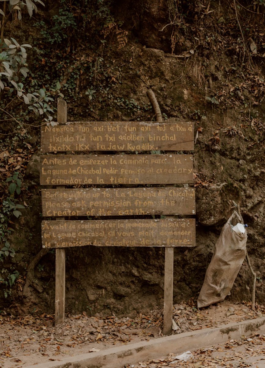
In the village of San Martín Sacatepéquez, wooden plank signs in four languages request that visitors ‘ask permission from the creator of the earth’ before commencing their walking up to La Laguna de Chicabal.
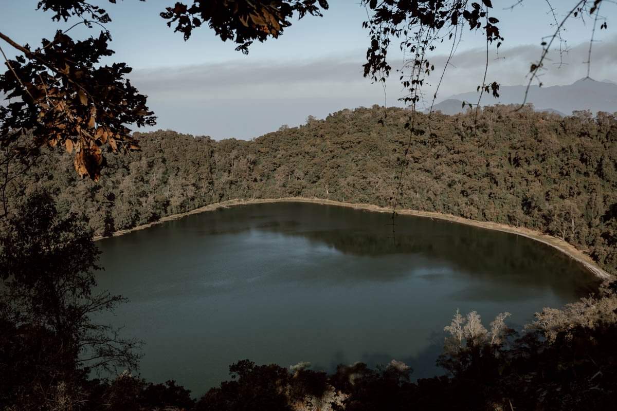
Surrounded by one of Guatemala’s last cloud forests at 2,712 meters (8,879 feet), for travellers the crater lake is a half-day trip from the Western Highlands city of Quetzaltenango.
But, for the Mam-Maya communities that make up about 8% of the country’s population, it is the centre of the world.
We spent a morning there and, fortunate enough to have climbed and visited many a Central American volcano and crater lake, would have described it merely as ‘pleasant’ rather than ‘unmissable’ trip until we heard, then saw, the pilgrims across the water.
To read that a place is sacred is one thing, but to witness what that really means to a community is another. When we eventually decided it was appropriate to continue on and pass them, the wails had transformed into sweet hymns and songs of praise, led by a priestess with her back to the dark water and a scarf on her head.
If not life-changing, that fifteen minutes of listening to them across the shore was, most certainly life-affirming, and the sort of moment for which we travel.
Their song and the scene by the shores of Laguna Chicabal will stay with us both for ever.
In this guide, we want to shared everything you need to know to plan your own visit to Laguna Chicabal from Quetzaltenango. Aside from understanding the do’s and don’ts due to its position as one of two sacred volcanoes in Guatemala, there are a few important practical points on transport connections, annual closures, costs, legends, and weather conditions to be aware of too.
This is our guided to visiting Laguna Chicabal.

How To Get To Laguna Chicabal from Xela
There’s an easy, quick, and convenient way, or a more interesting, cramped, and sweaty way to arrive at Laguna Chicabal from the nearby city of Quetzaltenango (more commonly known as Xela).
We opted for a combination of the two.
The route to the lake is split into two distinct parts, with a couple of options available within each depending on your travel style, budget, time, and inclination to walk:
Part One | A colectivo or Uber from Xela to San Martín Sacatepéquez | 50 - 90 mins
Part Two | Walk from San Martín to the lake, or take a ‘torito’ pick-up truck | 20 mins - 2 hours
However you travel there and back, you’ll need to set aside a half-day for this day trip from Xela, and we’ve shared the key details, locations, and costs below to help you pick and choose how you do it!
Note that clouds are an important factor when planning your departure time and means of transport, as it’s common for Chicabal to be shrouded in them from around 10am (give or take). That doesn’t mean you need to set off at an absurdly early hour like we foolishly did BUT, generally speaking, you will likely want to get up there in the morning for the best views.

Part One | Xela To San Martín Sacatepéquez
A. The Colectivo From Xela
Because we are quite used to travelling Central America, we got up ridiculously early to walk in the dark to a (hoped for) pick-up point 10-minutes from our Xela guesthouse. This was primarily because of the clouds rolling in by the late morning, but also because we planned to hike from the village of San Martín Sacatepéquez to the top of the crater (spoiler alert: we didn’t).
Understandably, many of you won’t be comfortable tracing the same route in the dark, but the good news is that there’s actually no point unless you’re on the strictest of budgets.
To catch the colectivo, walk to the highway near Democracy Market and wait on the side opposite the blue and white bus sign. This is the spot on Google Maps, and you’ll know you’re in the right place if there are offices for a company called Deseret on your left.
The colectivo arrived at 6am with the ayudante (driver’s assistant) shouting out Colombeeeeee and Coatepeque. They confirmed they stopped near Laguna Chicabal, so we hopped in with a few other passengers, before proceeding to set off on the slowest crawl we’ve experienced in all our years of travelling Central America with public transport.
The reason? It was the first bus of the day, but there weren’t many people waiting to get picked up at the roadside; the driver seemed to think they’d appear from nowhere if he fannied about for 45 minutes about at 10 mph
Of course, by the time we got dropped off, the minivan had gone from half-full to the Guatemalan ‘almost full’, with 30-odd people crammed in, and the driver still seeking additional fares.
Anyway, this just meant the journey took 90-minutes instead of the hour we’d planned for, and so getting up and leaving so early was utterly pointless!
The ayudante took the piss further by charging us 20Q each, when the price should have been no more than 10Q each. We’d recommend having small notes / change with you so you can hand over the exact amount (a general tip for travelling on Guatemalan chicken buses and public transport).
Anyway, enough moaning. The Laguna Chicabal drop-off is a well-established stop on the route, and the driver / ayudante should give you a shout as you approach the stop - it’s listed on Google Maps as Parada de Colectivos - La Laguna, San Martín Chile Verde Quetzaltenango. You’ll be dropped off on the right hand side, and should cross over to go down the road opposite.
From here, it’s an enjoyable and scenic 30-minute walk up through the village to the Chicabal road startpoint (Google Maps), with several red and yellow signs pointing the way.
Just remember to ask the creator of the earth for permission!
Time + Cost | 2 hours, 15Q
Travel Tip // San Martín Sacatepéquez is sometimes referred to as a San Martín Chile Verde. We’ve also been told the colectivo does not run on Sundays.

B. Uber / Taxi
As we’ve said in our Xela guide, for day trips - such as Volcan Santa Maria and Las Fuentes Georginas - Uber is a very established, affordable, and secure way to get around; this is particularly the case if you require an early morning start from the city.
Whilst the travel experience is rarely as interesting or insightful as the colectivos or chicken buses (unless you speak decent Spanish and get a loquacious driver), it sometimes really is the best option.
It will also be quicker than the colectivo - whether you take the first of the day or one later on - and bring you through the village and up to the Chicabal road start point too (however, a walk through the village is enjoyable, scenic, and insightful, so we’ll leave it up to you on drop-off).
You can also find taxis waiting the Parque Central, but they will likely charge more than the Uber and some may not wish to go out this far.
You should put the Toritos parking lot in as your destination (here on Google Maps).
Time + Cost | 1 hour, 70-130Q depending on time and traffic
Part Two | The Walk & Toritos To Lake Chicabal
Whether you’re dropped off or walk up there, all routes lead to the Toritos parking lot (Google Maps)
What’s a Torito we hear you ask? Well, of course it’s a pick-up truck with seats in the back, horns on the cab, and the nickname of ‘little bull’!
They run visitors up the dusty road to the lake entrance, and are the quickest and most convenient way to go to the top of the crater; the alternative option is to walk up the same road.
On the two-year trip through Latin America which started this blog a decade ago, and on many trails since, we have insisted on always walking for the experience, stubbornness, and our budget. That philosophy remains core to a lot of what we do at Along Dusty Roads but, with the knowledge that clouds descended upon Laguna Chicabal with seeming punctuality from around 10-11am, we decided to change our original walking plan and give ourselves a head start with the truck.
We were the only passengers and paid 100Q in total (cash only, no negotiation). It’s possible that the price would change if you had more passengers or were sharing the truck with others - or that we overpaid a little - so do let us know in the comments so we can update the post to help travellers like you!

Travel time to the top of the crater, via the ticket office, was about 15 minutes. Needless to say, if we had known about the Toritos, we would have definitely left Xela later when the city was awake and there was plenty of light. So, please don’t feel you need to do what we did!
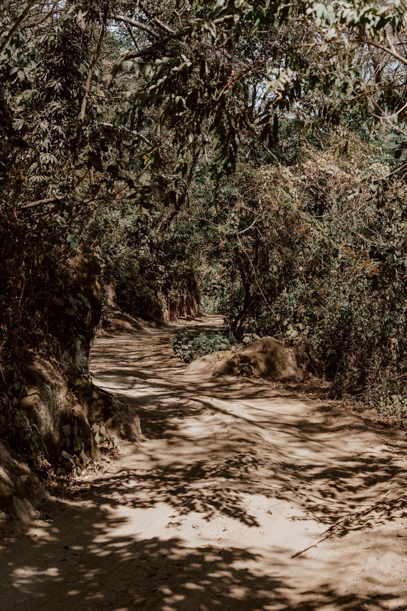
The alternative option is to walk up the same road, which is cobbles at the start before changing to dusty about half way up, and used regularly by farmers and potato pickers in the fields. It’s up all the way with some sections of steepness, but straightforward, with the only point to note being the fork in the road where you bear left (clearly signposted ‘Mirador A Laguna’).
From what we saw on the way up from the truck (and then walking back down the same way), you won’t be missing out too much if you opt to save time and energy with the Torito.
If you do walk up to the top of the crater, expect it to take around 2 hours to cover the 3km. You can find the route profile and more info here on AllTrails.
Time + Cost | 20 minutes - 2 hours, 0-50Q per person
Laguna Chicabal Tickets
Whether you hike or take the Toritos, everyone will pass through the tourism office, which is around a 45-minute walk from the top of the mirador (the trucks continue on after you’ve paid).
Here you’ll find a few simple pink and green cabins offering basic lodging, a shop, and the ticket office where you pay your entrance. Tickets are 50Q for foreign visitors and it’s cash only.
When asked, the ticket office guy said it’s not very common for foreign visitors to stay there, but you can just turn up and book it in person if you’re interested.
Note that no other transport except the Toritos is allowed beyond the tourism office, and we absolutely wouldn’t take any rental car beyond the Toritos car park.
The ticket office is open from 7am - 5pm

The Trails & Miradors
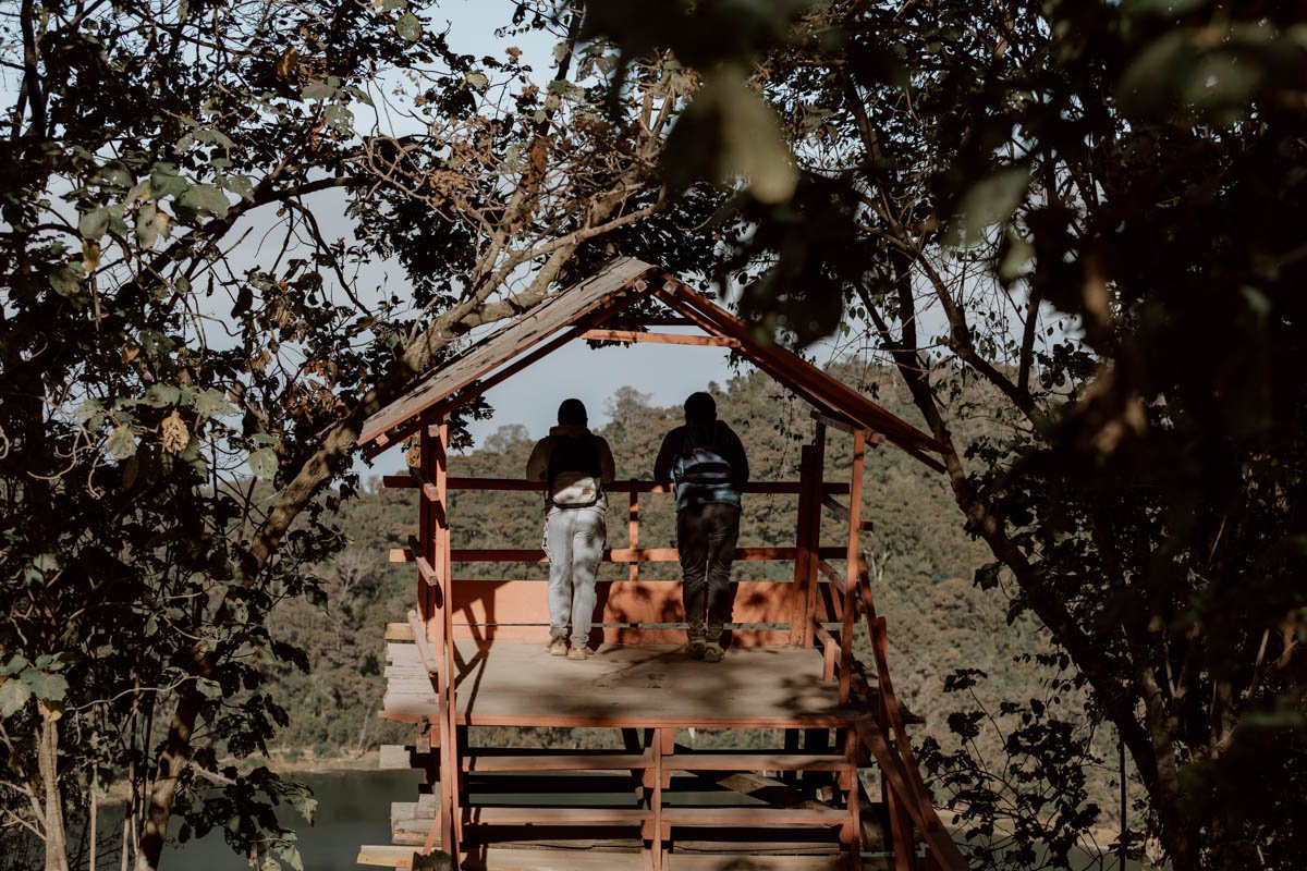
The Mirador
At the top of the crater, where the trucks drop off and pick up passengers, you’ll find two rickety treehouses - the right has a view (mirador) of the lake below, whilst the other looks out on to Volcan Santa Maria y Santiaguito; unfortunately, the view of those two was overgrown and overcast when we visited, so couldn’t really see anything. Hopefully you’ll have better luck!
Plan | If you’d like to hike it, read our Volcan Santa Maria hike guide!
The Trails Down to the Lake
You then have three options to walk down to the lake:
1. The main walk down via a few hundred steep trunk and wood stairs - signposted ‘Gradas’ and then clearly signposted again to the right of the treehouse as ‘Laguna Chikabal’. These are rough and steep stairs of trunk, plank, and wooden handrails, and you really do need to take your time on them.
2. Alternatively, there are also two ‘Nuevo Senderos’. The first appears to be an easier alternative to the steep stairs, and it exits at the same point on the lake shore. The sign said that it’s 10 minutes to go down - we didn’t take them, but think it’s likely easier and more enjoyable to go up / down than the incredibly steep steps.
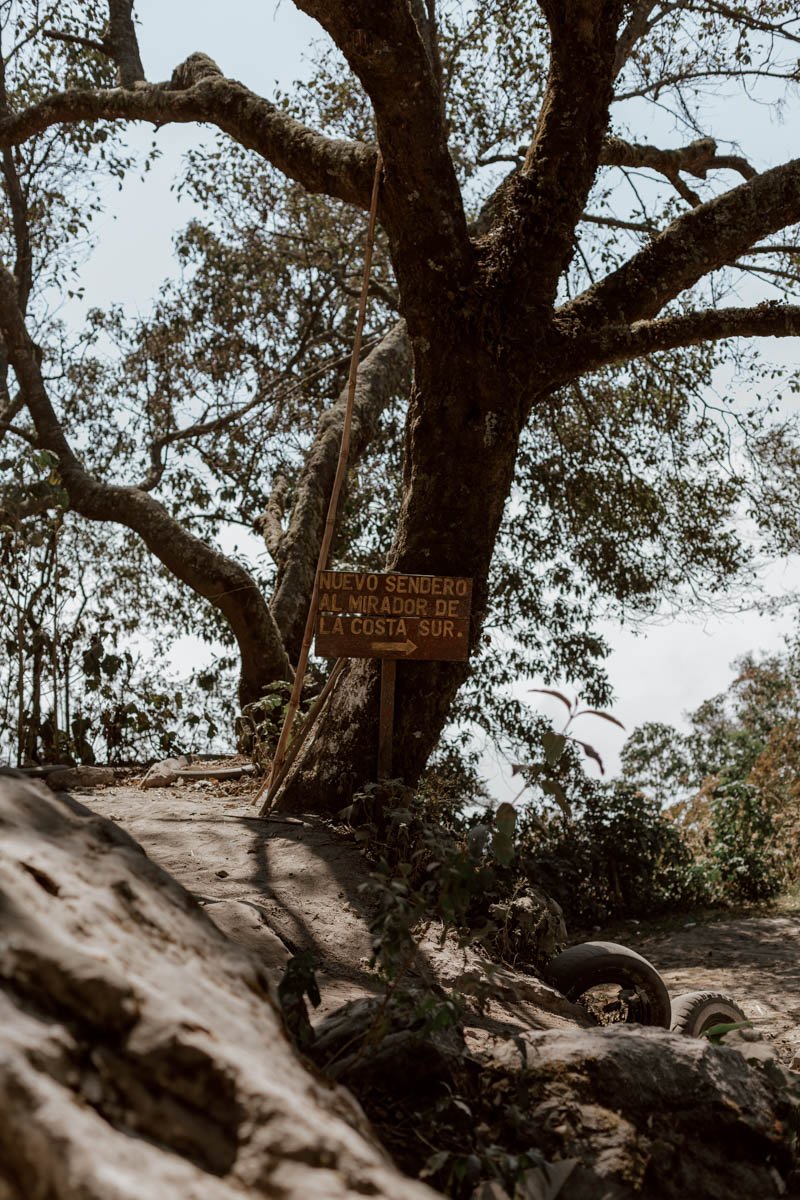
3. The other is found after the shop/cafe, and signposted ‘Nuevo sendero al mirador de la Costa sur’. It’s an unremarkable 10-15 minute trail down through trees, and it’s the one we opted for.
Note that, whichever option you take down, you can take the same or an alternative back up once you’ve circumnavigated the lake, and they all bring you back up to the same point.
The stairs really are brutal on the way back up though.
The Lake
As we mentioned, until we saw the ceremony across the water, Laguna Chicabal was simply a pleasant and scenic walk; nothing remarkable, and not something which wouldn’t have been near the top of our things to do in Xela guide.
Due to its sacred and protected status, you are not permitted to swim in the lake, and it isn’t a place that people come to picnic, play, or sunbathe.
So, as we walked around it in the mid-morning admiring the flowers and reflections, our views were mixed about how ‘worth it’ this was as an activity.
Of course, that all changed, but it’s important to share that very subjective prior opinion if the human and spiritual element isn’t there (which can’t be guaranteed and must always be respected).
So, once you’ve walked down to the shore and looped it in 30 - 45 minutes or so, there isn’t really much else to do or see. However, if you arrive with an appreciation of that, the stillness, the peacefulness, and the nature may mean much more for you.
That being said, you probably won’t need more than an hour tops down at the lake.
Also, don’t fret too much about cloud cover - it would probably only add to the mysteriousness and mythology of Chicabal.
The Return
We decided to walk back to the highway, and it took us 1 hour 45 minutes, including time spent at the shop having a much needed cool can of soda and chatting to the ticket guy.
Heading back to the main road (where we got dropped off earlier that day), we caught the next minivan for 10Q each, and arrived back in Xela at just after 1pm.
You could speed things up though by taking the Torito down to the village, which may be waiting at the top if you’re lucky. From the Torito station down to the highway, it’s about a 25-minute walk (note all the big new houses being built thanks to remittances from family in the US).
The only other non-Guatemalan visitors we saw here hiked up, but passed us in the truck on the way down.

Travel Better Tips
· The most important thing is to appreciate and respect the spiritual and scared importance of Laguna Chicabal to Mayans, and conduct yourself with the appropriate respect. As we exited, we had a quick chat the friendly guy at the ticket office who’s also in charge of the wee shop, and he told us that the site is sacred not just for those of Mayan heritage, but for all Guatemalans and religions. However, it’s for the former that it is most revered - thought to be the link to the underworld - and save for two other travellers, those we saw by the shore or in the back of Toritos to the top were all indigenous families and groups of worshippers.
We met two young guys in their late teens / early 20s that travelled for three hours to lay flowers down here!
· Respect for them, the site, their offerings, venerations, and their ceremonies is imperative and must underpin all visits and conduct, including photography and video.
· You cannot swim or bathe in the lake - and you 100% need to abide by this rule. There are only a couple of signs in Spanish noting this but, as it’s still a relatively off-the-beaten-track day trip from Xela, none in English and the lack of them is probably an indicator that dickheads don’t make it here; just make sure we all keep it that way!
· Laguna Chicabal closes to tourists in May, normally for a few weeks, in order for the most important Mayan rituals to take place in private. These usually start forty days after Easter, and it’s known as the ‘rain request’ ceremonies due to coinciding with the end of dry season and farmers hoping for rain and healthy crops. If you’re planning to visit around these dates, we recommend checking with hostel and tour providers in advance of setting out.
· You will see signs for a dry lake on the trail, and this has a Mayan legend underpinning it and linked to the ‘rain request’ ceremony . The story goes that this was once a sacred lagoon that locals used for bathing & washing, which angered the volcano. It decided to drain and dry itself, and the apologetic locals performed ceremonies to ask for the drought to end. With a clap of thunder, the new crater lake was formed above, and it was called ‘Chicabal’ (meaning thunder in Mam Mayan).
· Beyond the sacred and the spiritual, Laguna Chicabal is also a protected area and archaeological monument for the Guatemalan government. Interestingly, this was the most pristine and litter-free hike and environment we saw in Guatemala - a far cry from what locals leave all over the trails of Volcan Santa Maria - and make sure to leave no trace, and bring back any of your litter to dispose of elsewhere.
· There are a few small tiendas in the village and the surprisingly well-stocked shop at the ticket office, but nothing else for food or snacks along the way. There were a few benches and chairs at the top of the crater, and it looked like they may have been a small shop/restaurant there, but was shut when we visited. Perhaps there’s more chance of it being open on the weekends, but we’re not sure.
Therefore, if you’re going to hike, it’s best to bring breakfast or have it back in Xela. Also, bring plenty of water, as there’s unfortunately no fill up points for filter bottles (don’t use the lake).
· There were no toilets.
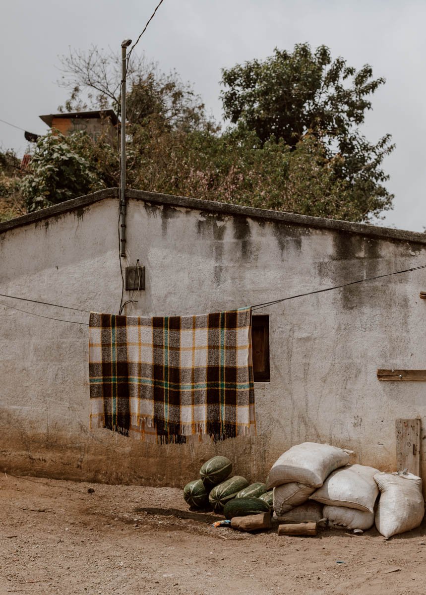
· Everyone was very friendly in the village you walk through, again a hearty buenos dias and a smile goes a long way.
· You don’t need proper hiking boots for the walk, trainers will be fine. It is chilly in Xela, the village and on the trail in the morning though, so make sure to wear warm layers you can dispense with once things heat up.

WHERE TO NEXT?
How to Visit Fuentes Georginas
The Essential Guide to Hiking Volcan Santa Maria
Central America’s Best Sunrise | Climbing Volcan Tajumulco
13 Wonderful Things to Do in Xela
The Xela to Lake Atitlan Hike | A Concise Guide