In this post, we’ve shared the essential advice and inspiration for any traveller looking to spend time hiking in the Cinque Terre. It includes an in-depth guide to the Blue Trail, all the resources you'll need for finding and following the dozens of alternative trails in the hills or by the sea, and tips for doing any hike safely and responsibly.
Updated November 2023

Although better known for its tumbling clusters of colourful villages by the sea, the Cinque Terre is also a fantastic hiking destination.
The myriad of dusty narrow trails, walked by farmers and locals for centuries, connect the cliffs and communities from Monterosso to Riomaggiore, as well as offering unrivalled views of the coastline and unique insights into what makes this area of north-west Italy so remarkable.
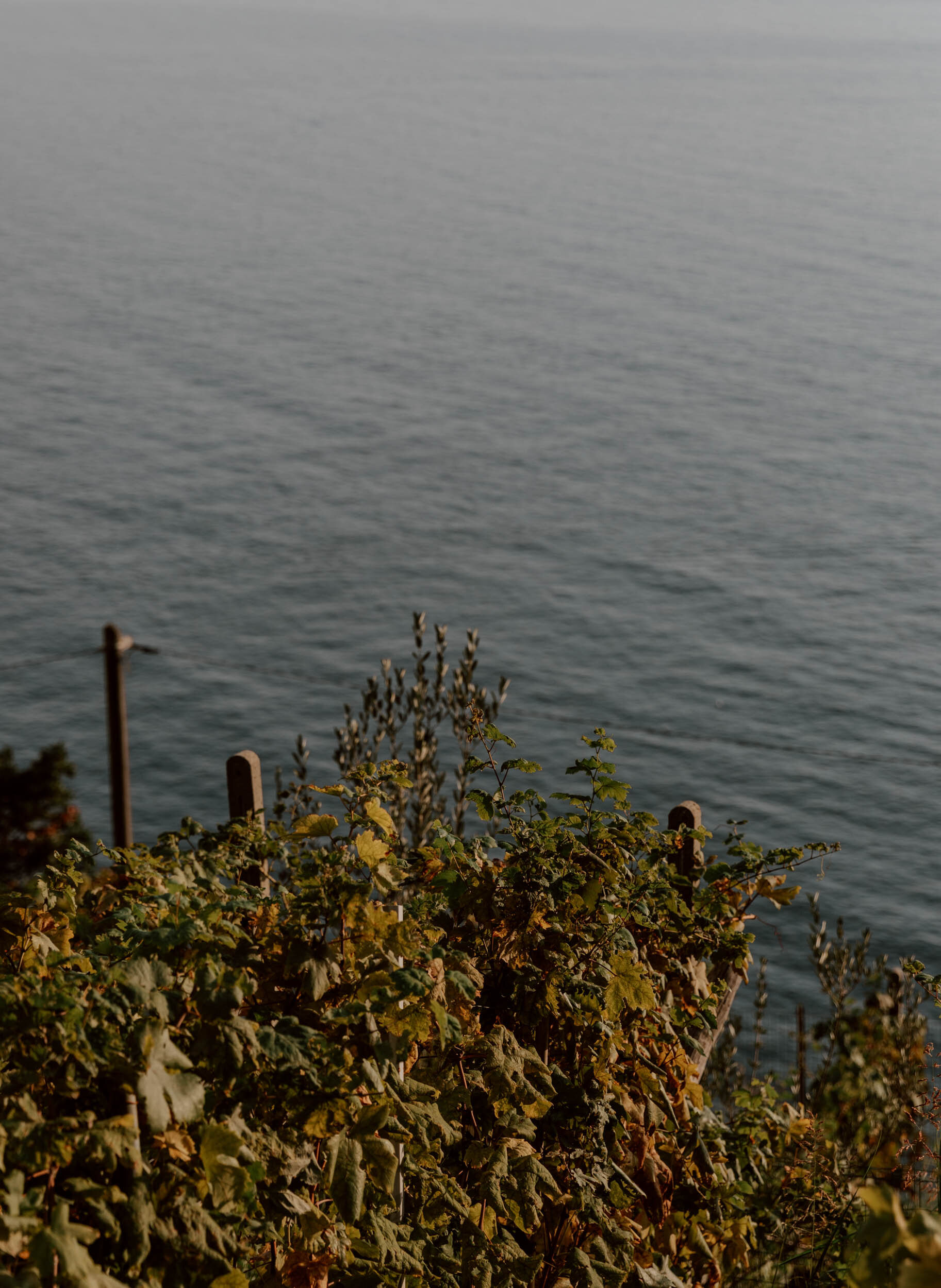
Indeed, the opportunity to walk alongside ancient dry stone walls and terraced vineyards, up steep stone steps or toward wild lemon trees and prickly pear plants - always with the sea somewhere nearby - is the principal reason we’d return.
And whilst serious hikers, or those who like to hike on holidays, may choose to base their entire trip around walking the 48 official trails in the national park, many smaller sections offer up an accessible and practical activity to those who would prefer to focus on the beaches, the food, and the incredible views.
In this guide, we’ve shared the essential advice and inspiration for any traveller looking to spend time hiking in the Cinque Terre - whether it's along a single section of the Sentiero Azzurro or one of the many less popular trails - with tips on costs, difficulty, and equipment required.
Given the popularity of the Blue Trail amongst all visitors to the Cinque Terre, we’ve included an in-depth guide to this particular hike, all the resources you'll need for finding, choosing, and following the dozens of alternative trails in the hills or by the sea, and tips for doing any Cinque Terre hike safely and responsibly.
Let's go.

The hiking essentials
// There are over 120 kms of marked, official walking trails within the Cinque Terre National Park, and exploring them is as popular a thing to do as lying on the beach, photographing colourful coastal villages, or sampling regional food and wine.
// The coastal Blue Trail (Sentiero Azzurro) from Monterosso al Mare to Corniglia is the most popular path, but is more challenging than many assume.
// It's mandatory to have a Hiking Card for the Blue Trail, which costs €7.50, but all other trails within the Park are free to access.
// The best months for hiking are April-May, September-November. There are fewer people and the climate is much more amenable than in peak summer season.
// Responsible, considerate, and sensible tourism is essential on these trails, and it's imperative that all visitors follow the rules of the National Park. This includes wearing appropriate footwear, understanding physical limitations, and leaving no trace.
The Blue Trail
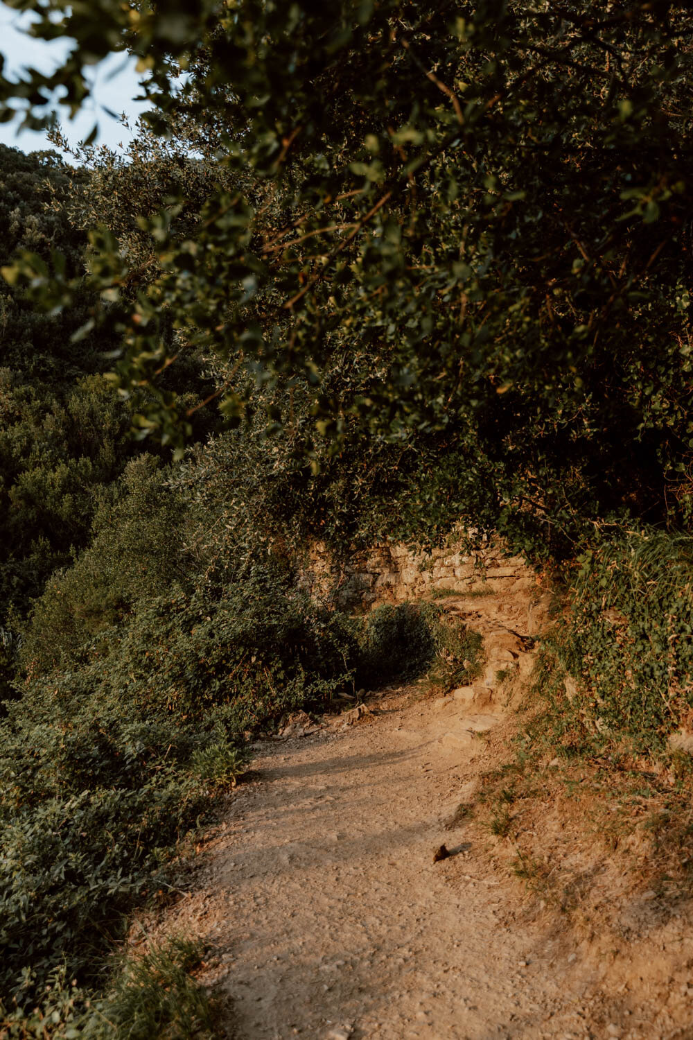
We had our hearts set on walking this during our week in Cinque Terre, and it was the main reason we chose to base ourselves in Monterosso al Mare for the first few nights. A narrow dusty coastal path through terraced vineyards on the steep hills overlooking the Ligurian Sea, it showcases the unique, challenging, and beautiful topography of the Cinque Terre as well as bringing you to three of its five famous villages nestled atop or within the cliffs.
It certainly isn’t off the beaten path (the path is beaten daily by many, many others), but it remains a classic Cinque Terre experience, and the most popular Cinque Terre hike.
The Route
Monterosso to Vernazza | 4.2 kms / 2.6 miles (allow 90 minutes to 2 hours at a leisurely pace)
Vernazza to Corniglia | 3.4 kms / 2.1 miles (allow 90 minutes to 2 hours)
The Blue Trail, also known as Sentiero Azzuro or Trail #2, historically connected all five villages (Monterosso - Vernazza - Corniglia - Manarola - Riomaggiore), but a landslide almost a decade ago meant the longterm closure of the Corniglia - Manarola - Riomaggiore sections. If you have your heart set on the short, famous Via dell'Amore, then it's important to know at the outset that this is included within the closures and not slated to reopen until July 2024 (it was supposed to be open for summer 2023, but has been further pushed back).
Therefore, hiking the Blue Trail at present is limited to the 7.6 km / 4.7 mile section running from Monterosso - Vernazza - Corniglia. You can decide to start in Monterosso, start in Corniglia, only walk a single section between two villages, or to do the full length and connect it to another trail (more on that later).
As we love to hike and had dedicated a full day towards doing the Blue Trail, we decided to start in Monterosso al Mare and follow the path to Corniglia, and to walk the same path back in the opposite direction. We’ll absolutely be in the minority to have made that decision, but we wanted to experience the Blue Trail in both directions and different light conditions, needed to sweat off some of that pasta weight, and hoped to give you a definitive insight on which is the best start point for your own adventure!
It’s a pretty straightforward, short trail and for experienced hikers or those with a good level of fitness, the Blue Trail will present no real challenge or concern (note that this is a trail to enjoy and appreciate for the views and experience, rather than a competitive route). However, from stories we’ve heard and a lot of the signage in Cinque Terre, it’s clear that many people who have not done adequate research into the terrain or their personal fitness level arrive in the region and spontaneously decided to walk the Blue Trail - subsequently they find it incredibly difficult and there are numerous instances of rescues (more advice on this later).
As an indicator for timing, it took us three hours to go from Monterosso to Corniglia at a leisurely pace with a bunch of photo stops and a drink along the way.
Note that if you’re based in another village, like Riomaggiore, then the best idea is to take the short train ride to either start point in Corniglia or Monterosso.
Entry Costs
It's necessary to purchase the Cinque Terre Hiking Card (€7.50 per person for a one day hiking card, €4.50 for children, and other concessions available) in order to access the Blue Trail - we explain in more detail about what this card includes and where to buy it in 23 Things To Know Before Visiting the Cinque Terre.
You will be required to show this card at the trail checkpoints upon entering / exiting each village and, if you haven't bought it in advance, then you should carry cash in order to purchase there. If visiting in high season, then we highly recommend you buy it in advance as this allows you to skip the queues at checkpoint cabins and just show your card.
If you think you'll only hike one-way (therefore need to take the train back) or would like to some more exploring later on in the day, instead of buying the Cinque Terre Hiking Card, we’d recommend instead purchasing the Cinque Terre Train Card, which gives you access to both the trails and unlimited usage of the train network.
Checkpoint booths open at 9 am so, if you start the trail early, you may find them unmanned; this stills mean that you’ll have to buy the pass later on in the trail - fees support the National Park and maintenance of the trails.
Good to Know // If you think you’ll want to hike across a couple of days, it’s also possible to buy a Two Day Cinque Terre Hiking Card at a cost of €14.50 for adults (€7.20 for children, and other concessions available). This option is also available for the Cinque Terre Train Card.
Our Blue Trail Experience
At 8 am, we set off from our accommodation in Monterosso toward Hotel Porto Roca (Google Maps), where there was a sign (stating ‘per Vernazza’) pointing toward the path to take on the right. Follow this and the subsequent signs, via the swimming pool, and you’ll arrive on the official trail.
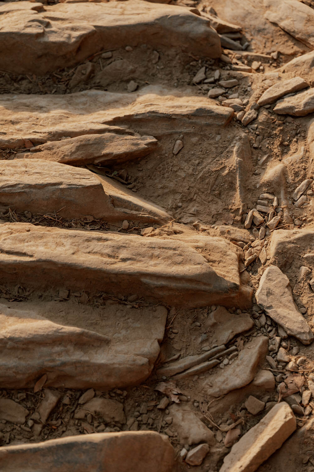
We were at the cabin checkpoint before it opened and proceeded to walk up the steep stone steps through the vineyards. The sun was obscured by cloud for most of the Monterosso to Vernazza section but, with a full day’s walking ahead of us, this was no bad thing. The initial 200m ascent from Monterosso via a few hundred stairs was the most challenging part on the old legs, but the trail then levels out and descends toward Vernazza with the sea your constant companion on the right hand side.
The approach to Vernazza is an absolute highlight, and it’s from here that you’ll be able to enjoy one of the most iconic viewpoints in the Cinque Terre, before descending towards the checkpoint and reaching the village. Knowing we were returning along the trail later, we opted to continue on to Corniglia immediately, but most of you may well choose to explore Vernazza a little first.
Read Later | Our Guide to Vernazza
In Vernazza, you’ll pass the main street and find the path continues up some narrow stairs on Via Carattino (here on Google Maps), with a red and white sign for Corniglia pointing the way. This is the next steepest section, and you may want a stop for a breather as you ascend the 200 metres or so upward - thankfully there is a wonderful view back on the village to savour about about two-thirds of the way up.

Pass the checkpoint, and continue up, up, up, and along the dusty trail to Corniglia.
A little oasis about half way along - very welcome on a hot day - is the fresh orange and lemon juice business at Bar Il Gabbiano (Google Maps), which offers a spectacular view of Corniglia atop its cliff as well as welcome refreshment (€3 for a small glass of OJ). We just wish they used less plastic.
Alternatively, you could stop in at the nearby Leo’s Lodge which is a little fancier, has an even better view, as well as some stupendously located accommodation.
Continue onward on the narrow trail, and you’ll eventually exit out at the checkpoint (Google Maps) and on to the main road which leads into Corniglia - the perfect stop for a long lunch, dip in the sea, or a stiff, strong Aperol Spritz in the shade…you’ve earned it!
The majority of you will do the hike in this direction, after which you can simply make your way to Corniglia station via its many, many steps and hop on a train back to Monterosso or onto another Cinque Terre village. Alternatively, more serious hikers may want to connect up to the alternative path toward Manarola or another trail.
As mentioned earlier, you cannot at present continue on the original Blue Trail path along the coast to Manarola and Riomaggiore due to closures.
For us, well, the charming little village of Corniglia - and its delightful swimming hole - somewhat messed with our plans. So instead of lunch, a quick look around and that back on the trail to Vernazza, we opted to have a few drinks and a long lunch, spend a blissful couple of hours frolicking in the sea, then hop on a train to Vernazza to rejoin the trail there and continue the rest of our journey along the sentiero azzuro during golden hour.
The views were absolutely spectacular, and the trail glowed gold in the late afternoon sun.
Making it back to our guesthouse in Monterosso just before sunset, we were dirty, sweaty, dusty and in need of a cold beer but it had been the best day - exactly the type for which we travel!
Our Blue Trail Hiking Tips
We've included general advice for hiking the Blue Trail, as well as other trails in the Cinque Terre, at the end of this post. Our specific tips and advice for the Blue Trail are:
// The hike startpoint in Monterosso can be found here on Google Maps, simply follow Via Corone, pass the hotels, and follow the signs. If you arrive at Monterosso train station, it’s about ten minutes walk away, just turn left when exiting and go toward the tunnel. The start point in Corniglia can be found here on Google Maps.
// Don’t underestimate the distances and terrains involved. For experienced hikers or those with a decent level of fitness, doing this hike one-way at a leisurely place will not be a challenge, but for some people the ascent from Monterosso to Vernazza and other parts will be. This is not to discourage or make you despondent, it’s simply to set expectations and ensure that nobody goes out on the Blue Trail and puts themselves and others at risk.

// This is covered in detail in the final section of this blog post, but the most important thing to note is that this trail has steep ascents and descents on stairs and is largely along old narrow uneven dusty paths. It is imperative that appropriate closed footwear with suitable grip is worn, not only from an enjoyment perspective but as it’s a legal requirement of access (this means no flip flops or sandals!). Hiking boots aren’t required in dry, summer conditions.
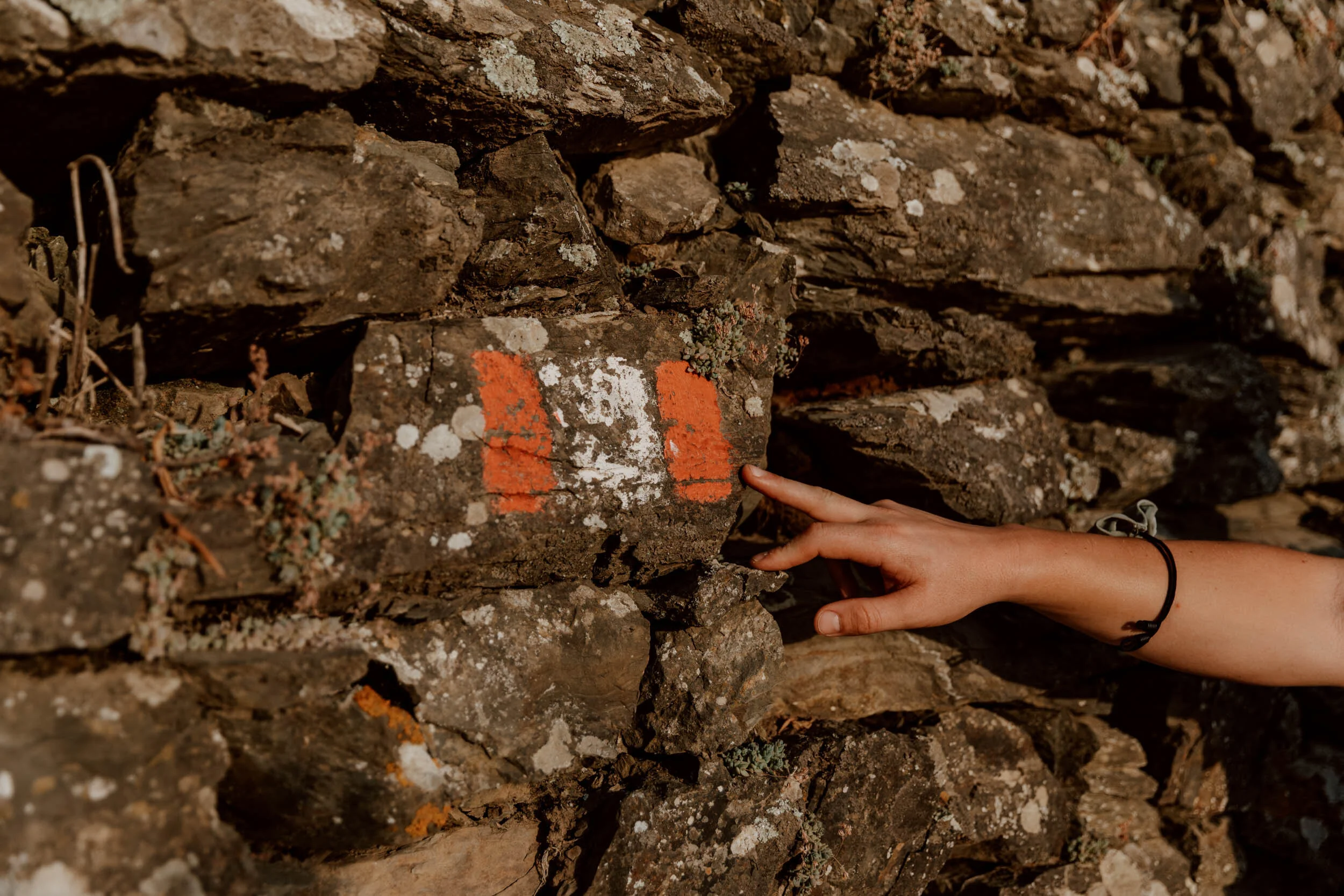
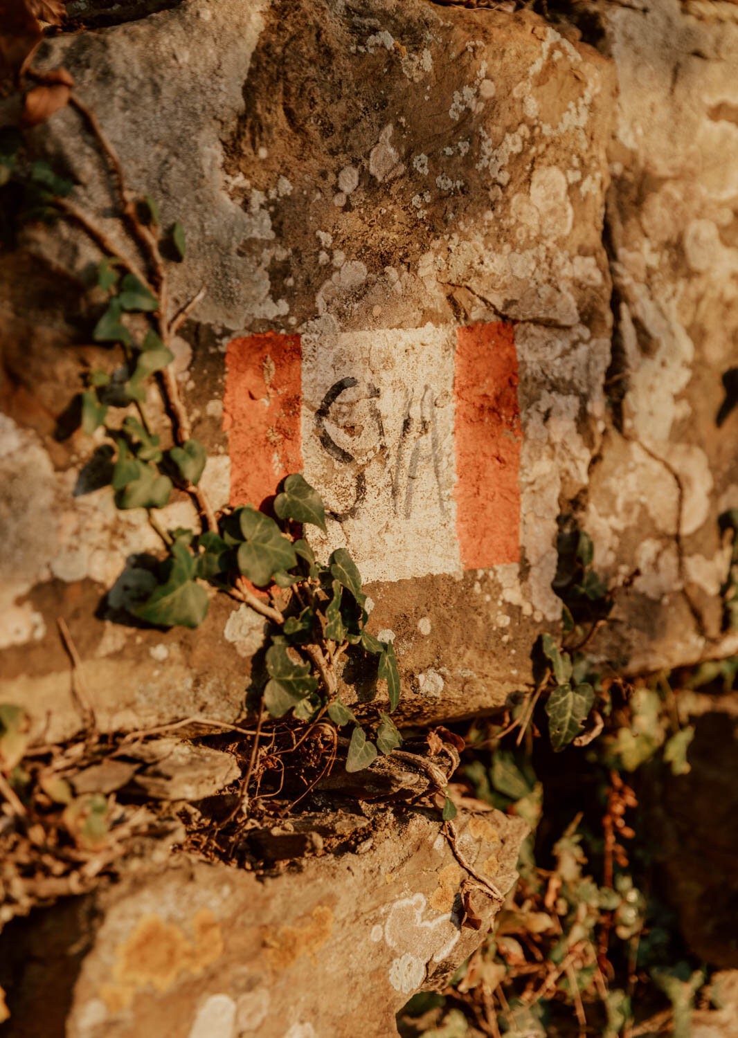
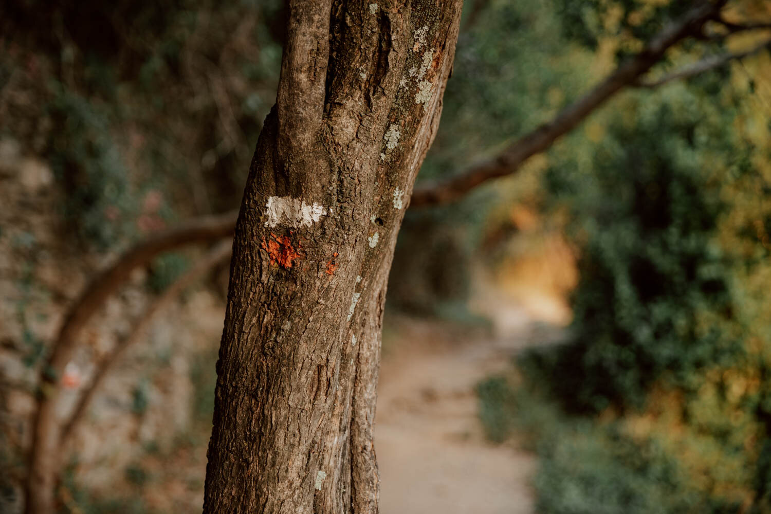
// The trail is well-signposted throughout by a combination red and white markers, a bewildering number of emergency medic checkpoint signs (an indicator of how many people in the past have underestimated the trail), and other signs. You shouldn’t get lost, but it’s not a bad idea to have the route on a downloaded Google Map or a paper copy for reference.
// Those emergency medic checkpoints list all the key information rescue services will require in the event that you or someone needs assistance, including your location and coordinates, plus emergency numbers for the National Fire department (115) and medical help (118). Obviously, these numbers should only be used when necessary.
// Look out for the cat sanctuary!
// Remember that the Cinque Terre train can be used smartly before or after the Blue Trail. It can bring you to the start point, bring you and your tired legs back home at the end of the hike, or quickly take you forward to another village if you wish to include a bit more exploration that day.
Where should you start the Blue Trail?
Whilst there may be slight differences in up and downs, and varying merits of ending in one town over another, whether you start the Blue Trail in Monterosso or Corniglia is really pretty much of a muchness - and definitely not a decision that should cause you any stress.
Indeed, should you be so concerned about the differences in ascents from one to the other, and your ability to pass them, then that may mean that this isn’t a trail you should actually be walking.
However, having done it (mostly) in both directions, we would probably recommend starting in Monterosso al Mare. Yes, the ascent at the beginning will wake your thighs up, but it’s absolutely manageable and gets it out of the way early. The two main reasons for starting there though are because the approach to Vernazza, and your first glimpse of the village below, are special, and we’d much rather end the one-way hike with lunch and a few hours in Corniglia over Monterosso.
If you prefer traditional sand beaches though and can’t face more stairs, we appreciate that you may actually prefer to have Monterosso as your end point; just be aware that by afternoon there will be limited space left on the beach, both in the free areas and the lidos.
If you’re still unsure, we recommend checking out our guides to Monterosso al Mare and Corniglia to help you decide…

Alternative cinque terre Hikes | Resources + Ideas
Given the popularity of the Cinque Terre, it shouldn't come as a surprise that the narrow Blue Trail can become congested. For serious hikers, those of you with more time, or who would simply prefer to walk a different trail, then there are plenty of alternative options (see the map below).
All of these hikes are free to access, and you can see how many of them intersect and connect allowing you to plot a bespoke route if you have the time and inclination.
As a quick guide, the colour code relates to difficulty level and current status:
Blue = Tourist trails (easiest, shortest and most accessible - not the Blue Trail talked about above)
Green = Hiking trails (short to medium length, but more challenging terrain)
Orange = Skilled (a good level of fitness and hiking experience required, with suitable equipment)
Black = Closed
The entire Cinque Terre trail network, including all individual hike descriptions, is listed here by the National Park authority. It’s not the most user friendly website or system however, and we found it frustrating to navigate. It also lets you know about current closures.

However, this interactive map on the same website is a much better start point for an overview of the trails and their numbers, as well as more detailed route information, profiles, and directions. Within it, simply click on the red and white flag or the specific trail, to bring up everything you'll need.
This page also provides a good rundown snapshot of all trails and their start point.
Hopefully one of the options above will be made much more user-friendly in future, but all are a good place to start. Alternatively, you can find a number of the routes and trails here in Komoot or on AllTrails, both general hiking route apps - just remember to always double-check on the official websites or tourist offices on trail closures before setting out.
Finally, your next best option is to visit any of the Cinque Terre Tourist information offices found inside all of the train stations within the National Park. Aside from having a handy free paper map showcasing all trails in the network, the staff there are excellently placed to give you advice on which trails you can take from that village, their difficulty, and whether they're currently open.
Lastly, there's the official free app for the Cinque Terre Park - ‘Pn5t plus’ can be downloaded for free from the Apple Store or Google Play but it’s a bit buggy.
There are too many routes and trails for us to cover them within this article plus, long-time readers of Along Dusty Roads will know that we only really like to provide advice and recommendations on hikes or experiences we've personally undertaken. However, we've done additional research to get you started on some alternative, less busy Cinque Terre hikes which appeal to us, which you can find below.
#1 The High Path AV5T
The go-to option for experienced hikers looking for more of a challenge than the Blue Trail, this trail runs along the ridge for 35 km / 22 miles from Portovenere to Levanto over Punta del Mesco. Also referred to as ‘path number 1’, it includes an ascent from sea-level of 800 metres.
A more realistic option may be to do shorter sections of this trail, incorporating paths down to the villages i.e. trail 506 to Manarola), 507 or 508 to Vernazza.
Find out more here.
#2 The Sanctuary Trail
An option for skilled and experienced hikers, the challenging 25 km / 16 mile Via dei Santuari starts in Monterosso and incorporates several religious sanctuaries, built to protect villagers from the risks they faced from sea and land.
Find out more here.
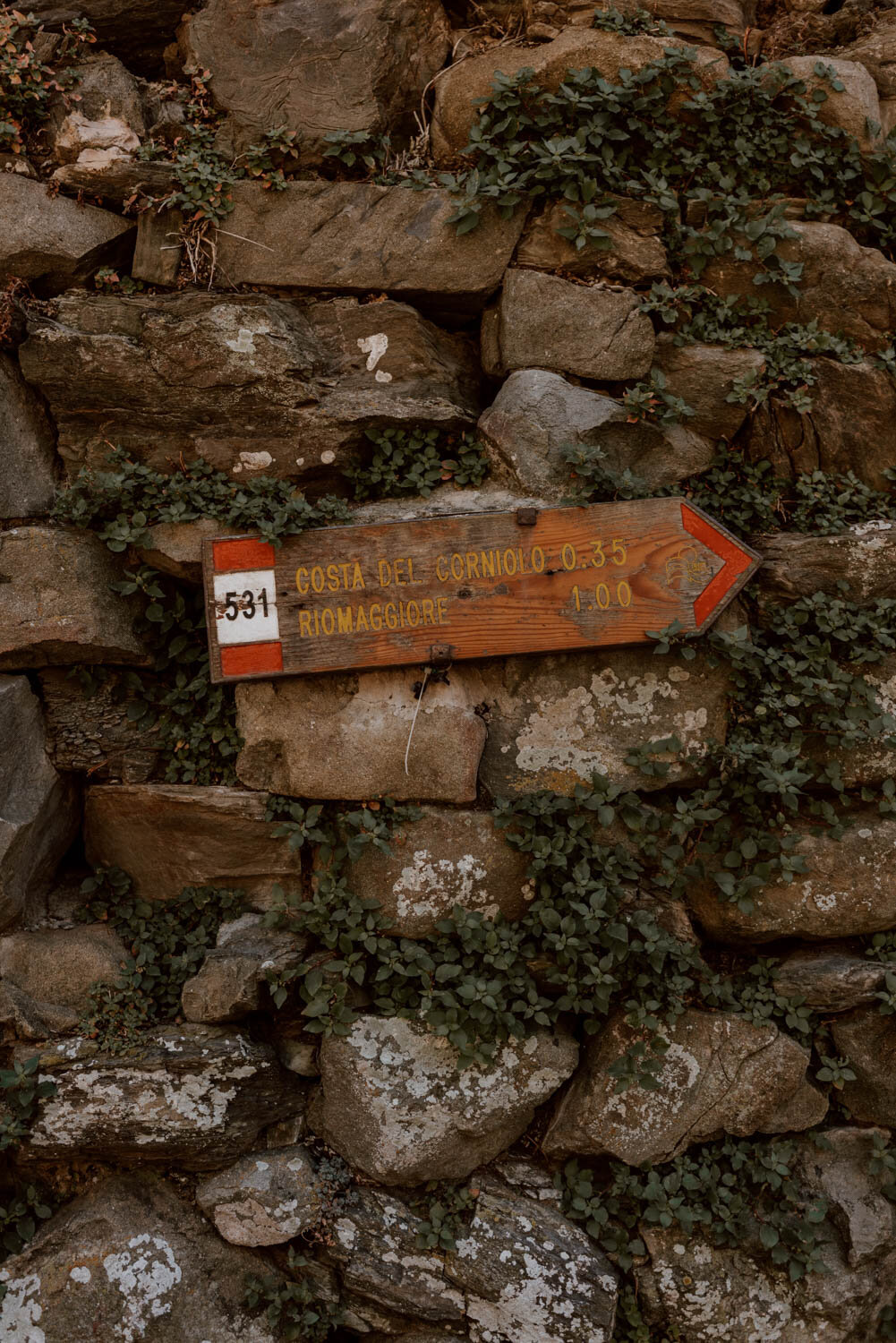
#3 Vigneti terrazzati Trail
Following the old path (531) which connects Riomaggiore and Manarola via Beccara, this short hike is considered one of the most panoramic within the park and offers a realistic day hike alternative over the train between the two villages. Manarola is also a great place to spend the day by the sea - find out more in our short guide.
Find out more here.
The keen-eyed amongst you will note that it’s definitely possible to design a route using the various paths which will take you to each of the five villages, something which the Blue Trail is not presently able to do, but we’d only recommend attempting this if you’re an experienced hiker.
Read Later | 13 Wonderful Things To Do in Cinque Terre

Hiking Tips | How To Do It Safely & Responsibly
As we discuss in more detail in 23 Things to Know Before You Visit the Cinque Terre, the park and its five villages are struggling under the pressures of overtourism - and it's the duty of every one of us fortunate enough to visit to be a considerate, responsible traveller.
Whether it's the Blue Trail or an alternative hike, everybody walking the Cinque Terre's trails needs to prepare appropriately and respect rules and requirements. This is not simply to ensure your own enjoyment, but to support efforts to preserve the National Park and decrease the negative impact of tourism on locals
The majority of people who love to hike and love being in the outdoors are usually pretty good at this anyway, but we are too long in the tooth to take that for granted.
Please take it seriously, use common sense, and follow the below guidelines and tips for the trails.
Research
// Wear appropriate shoes. It's compulsory to wear closed shoes with tread or grip on any trail, and you can be fined up to €2,500 or denied access if this is not adhered to. If you're not packing for a serious hiking trip to Italy, then ensure you at least have a pair of trainers good grip on them (i.e. not Converse). You cannot (and should not) wear open-toed shoes, hiking sandals, flip-flops, or ‘smooth / non-slip Vibram-type’ soles on any trail.
// The responsibility for ensuring you have the appropriate fitness, mobility, and equipment for each and every trail is on you. From the sheer number of advice signs and 'medical emergency' checkpoints on the Blue Trail, it's clear how many people take on this hike specifically without doing any research about whether it's sensible to do - and this has led to significant rescue costs for the National Park.
// As mentioned, the best months for Cinque Terre hiking are April, May, September, October, and November. There are fewer people and the climate is much more amenable than in the peak summer season months of June to August. If doing any trail in summer, please set off early, bring extra water, and avoid walking during the peak midday sun.
// Trail closures are common in the event of landslides, adverse weather, or necessary maintenance. Check for this before setting out on any hike via the resources linked to above or at the Tourist Information offices, as well as checking the weather forecast the night before. Note that the paths become very slippery with even a little bit of rain.

// On the Blue Trail, as well as others, you'll find little red and white markers on wooden signs, or painted upon trees or rocks, signposting the way. It's always a good idea to have the route map on paper or downloaded offline as a back-up.
// It's best to start the Blue Trail, and others, earlier in the morning to avoid the worst of the crowds. Early starts and making sure you're not walking the trail during the peak summer sun, also reduces the chances that you'll face difficulties. There is no lighting on the trail, so do not leave the last leg too late.
// You can take the frequent Cinque Terre Express train to / from any start or end point on the Blue Trail, whilst buses may be the best option for alternative hikes. This is a sensible and a good 'plan B' if you'e running out of time, energy, or light. The Cinque Terre Hiking card includes free bus travel, whilst you can also include unlimited train travel too. Find out more about the card, the transport system, and costs in this post.
// All these hikes can be done independently and a guide is not required. However, the National Park does offer walks with an authorised guide - you have to email them at visteguidate@ati5terre.it for more information.
// There are several short and long trail options from all the villages, and you don’t need to feel obligated to do a hike which is outside your comfort zone! Similarly, you can choose to do one section of a longer hike or spread the hike out over several days.
// Travel insurance is something that all of us should have, especially if doing more adventurous activities on the road. We use True Traveller, and you can find out more about how travel insurance works in this post.
Leave No Trace
// Do not trespass or leave the path - especially you Instagrammers. There are numerous, clear signs to aimed at preventing this, but we know that far too many people don't give two shits if there's a viral photo they want to copy. Drones are not permitted (and you’re a dick if you break this rule).
// No camping is permitted on the trails or in the National Park.
// Do not pick the grapes. You will be privileged to pass alongside numerous terraced vineyards along the Blue Trail, and these are largely worked by hand and basic monorail machinery given the challenging terrain. Although you may be tempted to pick a grape or two, it's imperative that you do not. These are active, small-scale vineyards, and you only have to think of the impact on the vintner's income and produce levels if each of the tens of thousands of people on the Blue Trail decide to pick a grape.
// Take all your litter with you, don't pick or disturb flora, don’t disturb or agitate wildlife, and don't graffiti or mark the signs or nature.
// Dogs must be kept on a leash at all times.
// Hiking etiquette varies from country to country, but it's important to have respect for the trail as well as those you're sharing it with. A quick nod and 'hello' or 'salve' to people you meet along the trail goes a long way, as does patience with others if there's a traffic jam or queue for a photo spot. Further, good etiquette on narrow trails such as these is to stop and wait for those ascending to pass first.

Equipment & Clothing
// Just to make sure this point is crystal clear - wear appropriate shoes!
// Bring plenty water with you on the trails, and pack a reusable water container for you hikes to fill up at fountains in the villages along the way. Make the most of the orange juice shop between Vernazza and Corniglia, or grab a beer or soft drink whilst exploring the villages between the trails.
// Wear comfortable, appropriate clothing for the climate and conditions, as well as putting on suncream. In September, shorts, vest and a headband were good for us, but we did need an extra layer for the morning section.
// Pack a little daypack with the essentials, along with a charged phone and plenty cash for lunch, snacks, and transport. It's a really great idea to bring your swimming stuff and a sarong / towel to lay on whether you're doing the Blue Trail or any others which pass through a village - the temptation to take off your shoes and have a spontaneous dip in the sea should be given into.
// Given the topography of Cinque Terre, steeps inclines and declines, as well as steps, are to be expected. Hiking poles are not necessary (unless you're Austrian) but would make a difference if you have bad knees or want extra stability - just remember to keep the rubbers on.
// 112 is emergency number to call.

YOUR NEXT STOP
13 Wonderful Things to Do in the Cinque Terre
Cinque Terre Village Guides | Monterosso, Vernazza, Corniglia, Manarola and Riomaggiore
23 Things to Know Before Visiting Cinque Terre
The Best Beaches in Cinque Terre
Where to Stay in the Cinque Terre
10 Things to Know Before You Visit Italy