
Hoping to hike Ben Nevis during your time in Scotland or on a day out? Our guide has all the essential advice and tips to get you ready to make it to the top!
Updated August 2023

“Because in the end, you won’t remember the time you spent working in the office or mowing your lawn. Climb that goddamn mountain.”
We didn't plan on climbing Ben Nevis in the early days of the Scottish summer.
The original idea for our second trip of Britain's grand reopening, after seeing family in Aberdeenshire, was to spend a week in Orkney. Yet, probably because we had sated our desire for the salty sea by the Welsh coast a few weeks before, being close to the water was no longer the primary primal urge after so long at home.
We needed a mountain.
And, when you need a mountain in Britain, it's to the Scottish Highlands you must roam.
In this guide, we've shared all the practical essentials to help you plan and prepare to hike Ben Nevis (Bheinn Nibheis), alongside tips from our own personal experience of climbing Britain's highest peak in sun, snow, blue skies, and thick cloud - all of which appeared on the same day! From where to base yourself, which of the two routes to choose, where to park + start, important notes on clothing, safety, and weather conditions, free map resources, and an honest view on just how difficult it actually is...we've got you've covered.
This is everything you need to know before climbing Ben Nevis - with a free checklist at the end.
The Ben Nevis essentials
Where / Stands in the western Scottish Highlands.
Nearby / Fort William is the closest town.
Altitude / At 1,345 metres (4,412 ft), it's the highest peak in Great Britain.
Hike / Most popular route is 10.5 miles (17 km), takes 7-9 hours.
Caution / Weather conditions changeable and pose serious safety risks.
Challenge / Part of ‘Three Peaks' Challenge with Scafell Pike and Snowdon.
Stay /Ben Nevis Inn & Bunkhouse, Glen Nevis Youth Hostel, or Glen Nevis Holidays.
ARE YOU HIKING OR WALKING UP?
Firstly though, a quick note on terms: does one climb Ben Nevis or does one hike Ben Nevis?
We've personally used both terms interchangeably, but serious climbers and mountaineers may argue that one merely walks up Ben Nevis.
It definitely deserves to be referred to as a hike, akin to the many ones we've done in South America and Europe. The 1,345 m elevation is a tiddler in comparison to some of those, won't cause any issues with altitude sickness and it’s easy to navigate, but the fact that you will be up there for at least 7 hours on the 'easy' Ben Nevis 'tourist trail' (more on that later) and some preparatory research is mandatory to do it safely, means it shouldn't be dismissed as just a wee walk.
However, to give the necessary glow of pride for those of us who choose to spend a day getting to the top of Britain's highest mountain when we could be sat in the pub, we are going to consistently refer to 'climbing Ben Nevis' in this post.
And, if you don't like that, then you can fight us by Loch Lochy.
A Complete Guide to Climbing Ben Nevis
WHERE TO BASE YOURSELF FOR BEN NEVIS
The small town of Fort William in the western Scottish Highlands was our base for hiking Ben Nevis and exploring Glencoe, and we'd recommend staying in and around there as the most convenient and accessible option for you too.
From the town centre, you can walk to the main startpoint in just over 30 minutes (15 if your accommodation is on the outskirts), or it's a 5-minute drive
You can also reach Fort William by bus or train if you're travelling without a car.
We've shared advice on things to do in town, transport connections, and our pick of the best accommodation, over in this post: A Wee Guide To Fort William.
There are also a few popular accommodation options within Glen Nevis, offering sumptuous views of the peaks, a remote location to wake up in, and a very short walk to the start point. These are:
Ben Nevis Inn & Bunkhouse (also a great spot for a pint at the end!)
Achintee Farm Guesthouse
Glen Nevis Holidays (Lodges, Cottages & Caravans)
Of course, you may be staying elsewhere in the region of Lochaber and wider Highlands, so may be coming from further afield for just the day. Typical drive times to the Ben Nevis start point for nearby popular destinations are:
Glencoe | 1 hour
Oban | 1.5 hours
Inverness | 2 - 2.5 hours
Isle of Skye | 2.5+ hours
Glasgow | 3+ hours
Edinburgh | 4+ hours
We've made the above times realistic and reflective of driving conditions, speeds, and traffic on these roads in the Highlands, rather than the quickest time that Google Maps shows going from A to B.
We'd strongly recommend that you don't try to go up and down Ben Nevis and give yourself the ballache of a 2+ hour drive to get home afterward, so that rules it out as a day trip from Glasgow & Edinburgh (and Skye too - literally no point being based there and going all that way).

HOW DIFFICULT IS IT TO CLIMB BEN NEVIS?
Although its designation as Britain's highest mountain* may be a little intimidating, the reality is that our mountains are actually not that high in comparison to Italy, France, Austria etc, and Ben Nevis is actually a relatively accessible and manageable day of hiking for most people who are mobile and have an adequate level of physical fitness. Although the first half is all up, up, up, then up some more, the main trail is quite straightforward and does not require scrambling or specialist equipment.
Experienced walkers and active people will have no real issues beyond tiredness and perhaps some sore knees by the end.
If you are not very active or are very unfit, we would recommend asking yourself if you're able to do an 8+ hour roundtrip hike safely before setting out. If the answer's yes, then please just ensure you follow all the advice at the end of this post on important things to do and know before you climb Ben Nevis. Hitting the highest peak in Britain is a great goal to have and it’s fantastic for everyone to want to enjoy the shared outdoors, so why not start having practice walks and hikes nearer to home now to improve conditioning, confidence, and make the overall experience more enjoyable too.
The weather and the season are the great equalisers on Ben Nevis though, and we've discussed this further in the below section.
*Pub quiz fans will rejoice upon learning that Britain’s actual highest peak is, bizarrely, in the Antarctic! Mt Hope measures in at 3,239m (10,626ft), and is sited in the part of the Antarctic claimed by the UK. We think that’s cheating though, so we’ll let Ben Nevis keep the title in the spirit of fairness.
WHAT'S THE BEST TIME TO CLIMB BEN NEVIS?
May to September is generally considered the ideal time for optimal, safe, and enjoyable conditions.
Your chances of clear skies increase, it's lighter earlier and for longer, and most of the snow at the summit should have cleared.
However, here in Scotland, one cannot expect consistent and reliable sunshine throughout spring or summer (or even for a few days in a row), so it's vitally important not to assume that the conditions are suitable just because it's June or July.
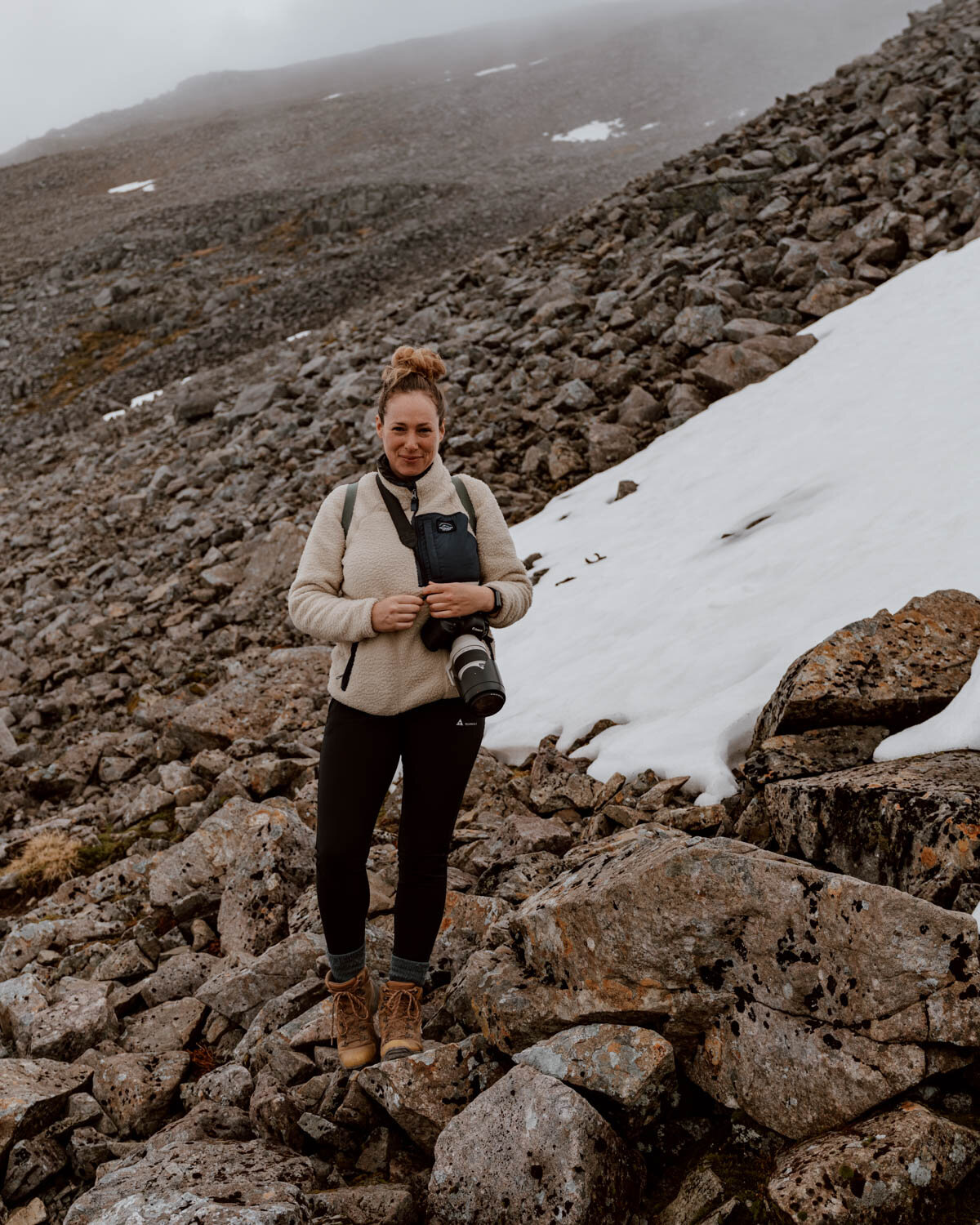
For example, our own hike in late May saw the summit still covered in several feet of compacted snow, making it a challenging - and slippy - last hour up and first hour down.
The summer months also coincide with the busiest season in the Scottish Highlands, with thousands of visitors going to Glencoe, driving the North Coast 500, or simply escaping from the city to this beautiful part of the world. Ben Nevis, as a very well known hike, attracts a fair number of this domestic and foreign tourism traffic itself, receiving around 125,000 walkers a year.
This is why it's important to think about your start time as well as the time of year for climbing Ben Nevis. We like to start our hikes as early as possible to increase the chances of solitude and a moment to experience special places before many others arrive, hence our ridiculous start time of 4.30 am from the Ben Nevis Visitor Centre car park. We aren't advising that everyone heads out that early, but just appreciate that the later you start in the morning (i.e. 9 - 11 am), the more people you'll be sharing the trail with on the ascent and descent.
We left the summit at 10 am, and were surprised at the number of walkers we passed on the way down during a midweek in May.
We do not recommend attempting to summit Ben Nevis in winter unless you are an experienced hiker with suitable specialist equipment, clothing, and knowledge. Aside from safety and enjoyment, you also have to factor in the much shorter window of daylight in which to hike and the likelihood of very tough weather conditions. Therefore, for hikes from late September onward (when the mountain sees its first snowfalls) to May, please do the necessary research before setting out.
At the end of this post, we’ve shared two fantastic free resources for checking weather and climbing conditions for Ben Nevis.
HOW TO CHOOSE THE RIGHT BEN NEVIS HIKE ROUTE
Right, now to actually tell you where to start and how to get up there!
There are two routes to the summit and they intersect for a section, but only one is suitable for the majority of people going up Ben Nevis.
The Mountain Path
Distance | 10.5 miles / 17km
Time | 7-9 hours
Level | General
Park | Ben Nevis Visitor Centre Car Park (Google Maps)
Start | As above. Note that it is sometimes referred to as the Glen Nevis Visitor Centre.
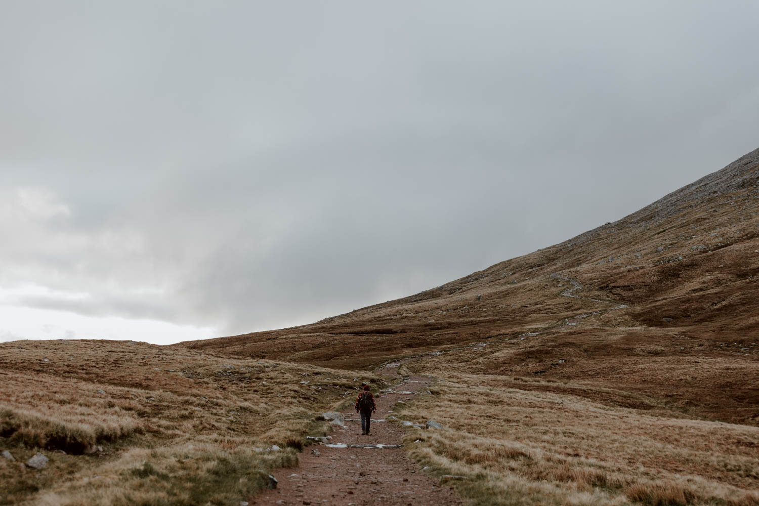
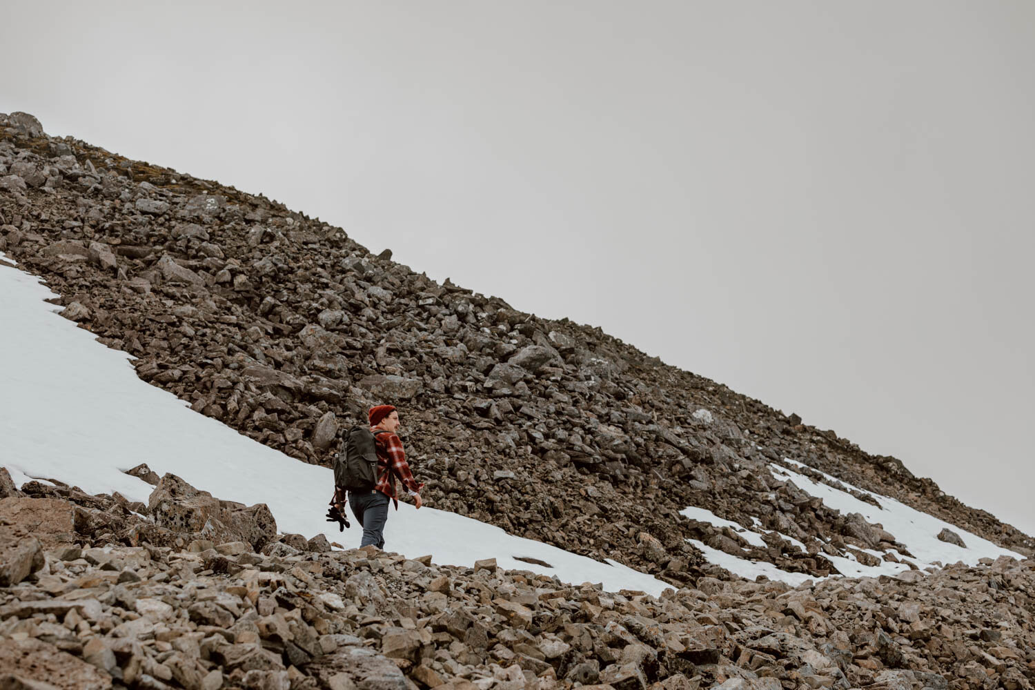
It's known by a few names - the Tourist Track, the Mountain Track, and the Pony Track - and we think the 'tourist' moniker is a tad misleading. It will be manageable for most fit people, but it's still a long, steep ascent for 4-5 hours, and the terrain becomes quite uneven near the summit.
It's not something you can just pop up to in you flip-flops to take a few photos of before moving on!
Route Profile & Map
There is very little signage on the trail but, once you're on the path, the route is quite straightforward and easy to follow except for a couple of points.
For us, it can be split into three distinct sections:
The Ben Nevis Visitor Centre to Lochan Meall An T-Suidhe
Leave the car park and follow the signs to go left, over the bridge and the river Ness, before taking another left along a narrow lane with a dry stone dyke on your right, fields either side, and the Ben Nevis Inn visible on the left. Cross over the stile, and then you’ll pick up the path going right.
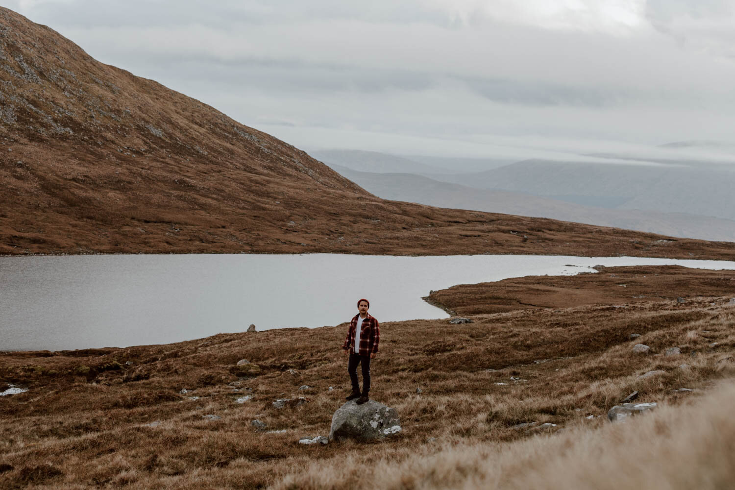
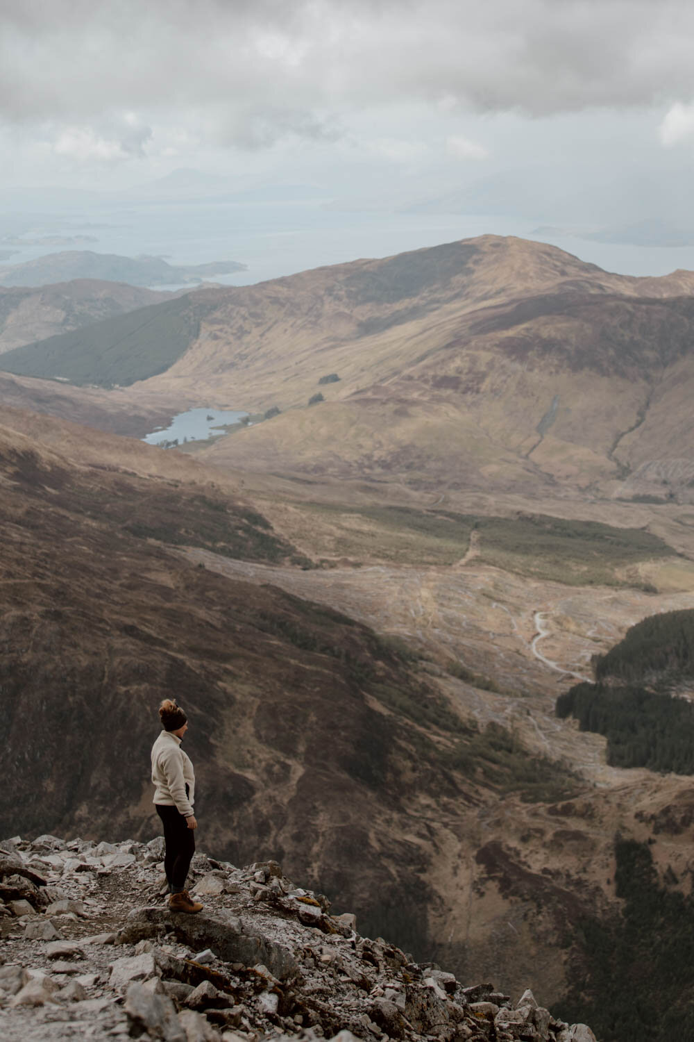
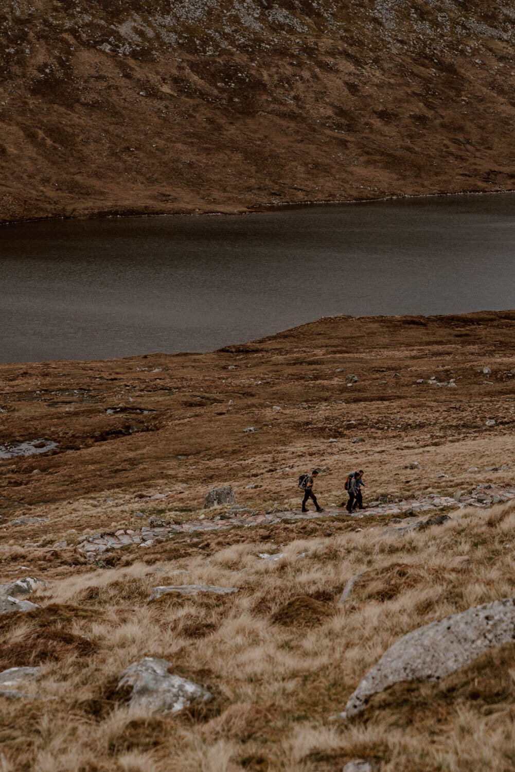
This first section is largely along good stone steps and clear path ways, though is quite uneven and narrow in parts. Once you pass the dark water lochan* (small loch) on your left, 507 metres above sea level, keep going a little bit and you’ll see your first and only junction.
Go right, not left (which leads you onto the more challenging, longer North Face route).
Once you’ve navigated that turn, this is a good place to sit down, have your breakfast / lunch / tea break, and enjoy the views.
If it has been a horrible, really difficult experience for you in this section, this may also be a sign that it's best not to continue for you. The weather in this stretch will always be better than the summit so, if it’s inclement, that’s not a good sign for what lies ahead and may shape your next move.
*supposedly it’s also known as the Halfway Lochan, but that’s a misnomer…the little stream you cross - the Red Burn - actually marks the halfway point.
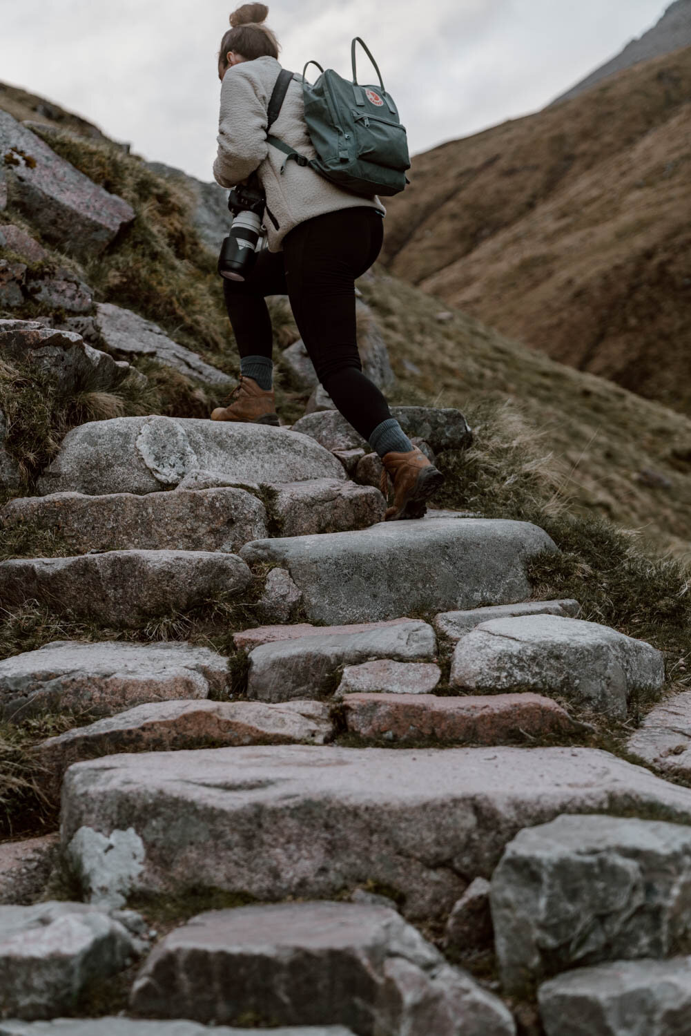
Lochan to The Summit Plateau
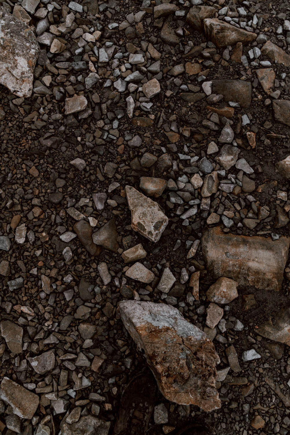
This next section is steep and not particularly enjoyable, with a series of switchbacks eventually turning into less stable and less clear rocky paths. You don’t have to scramble and it’s perfectly manageable, but it’s a good idea to keep one eye on your map / GPS to ensure you’re sticking to the path.
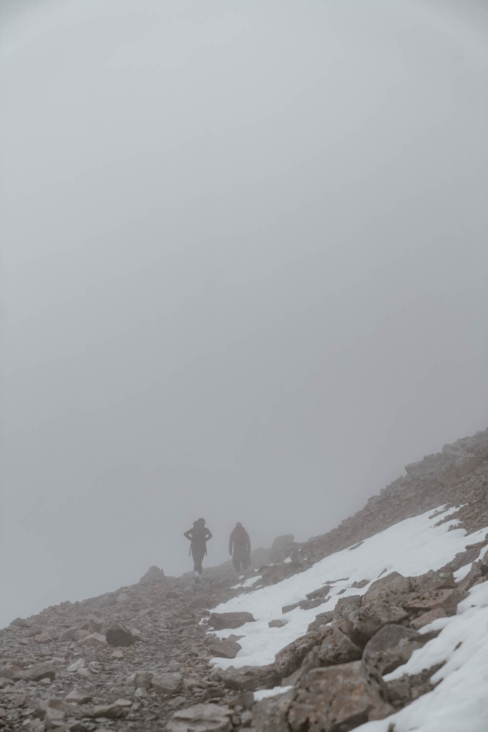
Expect visibility to worsen in this section, and temperatures to go down.
The Summit Plateau to the Ben Nevis Summit
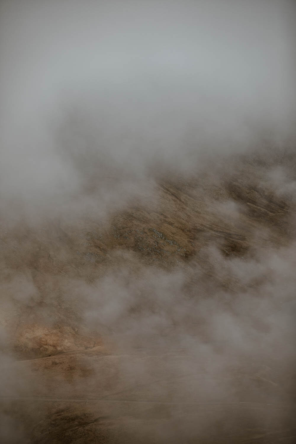
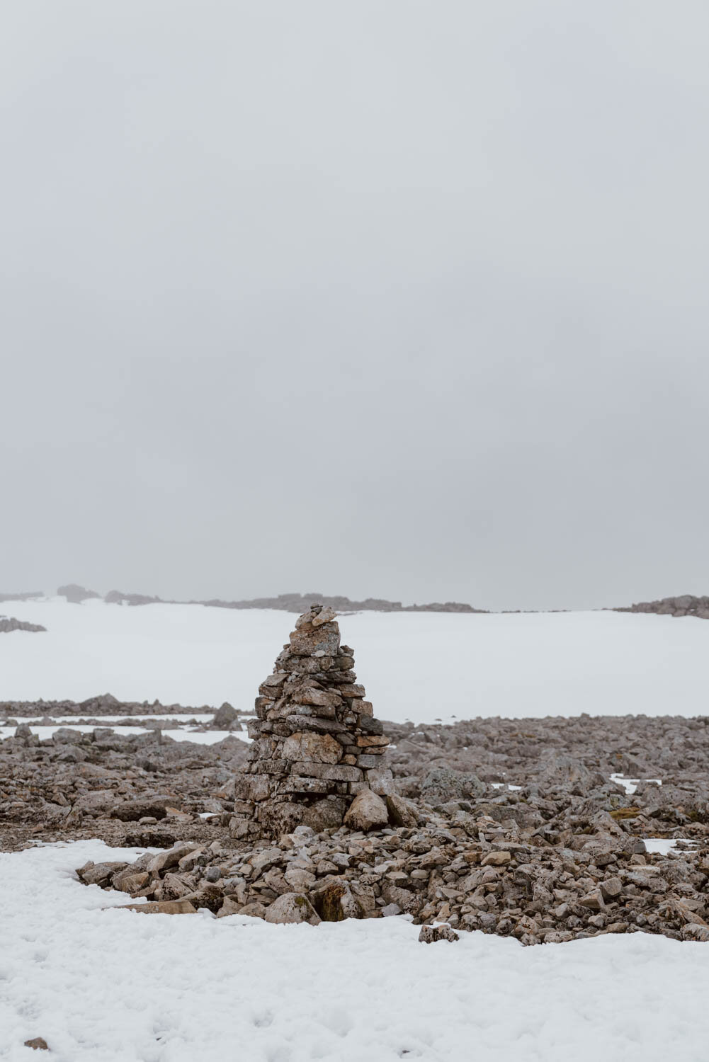
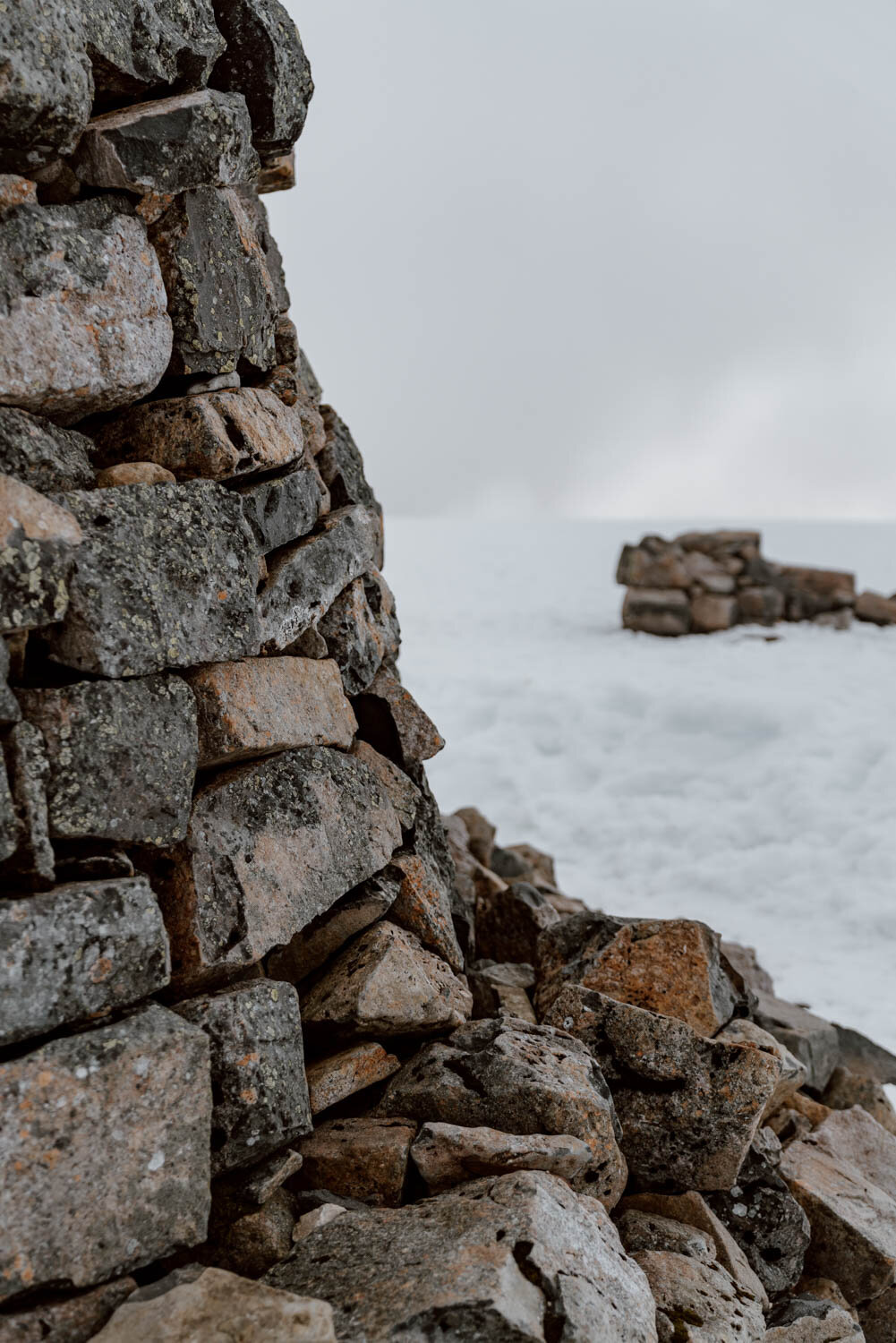
For us, this was such a memorable section. We were the first up Ben Nevis that morning, and the top was still covered in that compacted winter snow. The most surreal thing was how the visibility plummeted from pretty good to almost zero - with only the iconic cairns of the Scottish hills visible in the landscape. We bloody love cairns - they’re such a cool feature of old which will be useful to even the most modern of hikers - and they proved their use as waymarkers (alongside our downloaded map GPS) as we continued to the summit in a whiteout.
We’ll never forget that.
This section is not steep, but has more of a gradual incline and will eventually lead you to the summit which has a stoic lack of fanfare for your achievement or the special position you’re in on the island of Britain; instead it’s a simple marker with no words and the ruins of the old observatory.
Take time to enjoy the moment, capture some photos, have a break and some food…but please don’t dick around or wander blindly. The summit and summit plateau are deceptively slender, with gulleys and fatal sheers drops in close proximity.
The Way Down & How Long Should It Really Take?
As a guide, we started at 4.30 am and reached the summit at 9.25 am, with the walk back down coming in at just over 3 hours. Our pace was leisurely and, if we weren't stopping to take photos and have breakfast on the way up, or faced with snow and really poor visibility for the summit stretch, then we could easily have shaved an hour off that.
The walk down - which sees you follow the exact same route and return to the Ben Nevis Visitor Centre - was actually longer and more tiring than we thought it would be, so don’t let the pace drop too much after the summit.
Total time will be affected by your personal abilities, number of breaks, and conditions, but the most important thing is about safely enjoying the walk and the experience at your own pace - not knackering yourself on the way up.
Maps & Guides
A paper version of the route is always good to have and can be picked up in Fort William. However, we know many of you will be using your phones. In that case, it’s essential to have the route downloaded as an offline version as you cannot count on an internet when hiking or in an emergency (your GPS works without an internet connection)
We can recommend the following for the Ben Nevis Mountain Path hike:
Maps.me | This free app also allows you to download an offline route for Ben Nevis.
AllTrails | A great website and app for hikers and walkers all over the world, you can access all the necessary route directions and maps with an internet connection; you do however need to be a paid Pro member to store them offline. Find the Ben Nevis Mountain Path route here.
Google Maps is often a good option for a hike, but the Ben Nevis marked trail is not as precise as it should be and may lead to issues in sections. It’s always good it as a back up to have on your phone though - we’ve written this brief guide on how to download a Google Map offline.
Where To Park + Start
The best and easiest option is at the Ben Nevis Visitor Centre Car Park (Google Maps).
It's £2 for 1-2 hours, £6 for the day (no overnight parking), and there's space for about 80+ vehicles. There are several pay points but only the one nearest to the visitor centre takes contactless card payments, otherwise you need to bring exact change (not notes) - change won't be given. If the contactless doesn't work, then you can pop into the visitor centre to pay, but that's obviously an issue if arriving before opening hours.
In short, bring some change just in case.
From here, you're a one minute walk to the start point here: simply make your way toward the visitor centre and follow the signs left for Ben Nevis. It will take you across a short bridge over the river, then between two fields with the Ben Nevis Inn on your left, and finally over a sty on to the main path. It's pretty straightforward from there, but we've shared free route maps below for you to have downloaded in advance.
At the end of your hike, you can access the free public toilets at the Visitor Centre, pop in for a drink or snack, or buy a souvenir. Or you can also stop at the Ben Nevis Inn for a celebratory pint, dram, or some food.
There is alternative parking a walk away at the Braveheart Car Park (Google Maps) - it’s free, but only has capacity for 30 cars and should really be left for those who are doing other walks in Glen Nevis. There’s also limited free parking close to the trail at the Achintee Road car park, by the Ben Nevis Inn, but this is a lot less convenient than just going to the Visitor Centre.
If you choose to base yourself in Glen Nevis, rather than Fort William, then you will have free parking with your accommodation.

The North Face / carn mor dearg arete
Distance | 11 miles / 17.5km
Time | 10-11 hours (good conditions)
Level | Experienced hikers
Park | North Face Car Park (Google Maps)
Start | Ben Nevis North Face Trail (Google Maps)
This is for experienced hikers only due to the scrambling involved and potential conditions faced.
We did not go this way due to the conditions and our preference to save it for a future hike with no snow at the summit, so we will defer and refer you to two great resources with more specific advice and trail information - however, please ensure you read the final section of this post too.
Walk Highlands | Ben Nevis by the Càrn Mòr Dearg Arête
Steven Fallon | Ben Nevis and CMD arete hiking route
HOW TO CHECK BEN NEVIS WEATHER CONDITIONS IN ADVANCE
Whichever season or time of year you're planning to hike Ben Nevis, and whatever your level of experience, it is imperative that you understand the weather conditions 1,350 metres above Fort William are not the same as down by your accommodation.
It may be feel like summer has come early where you wake up in the morning, whilst the top of the mountain will feel like winter will never leave.
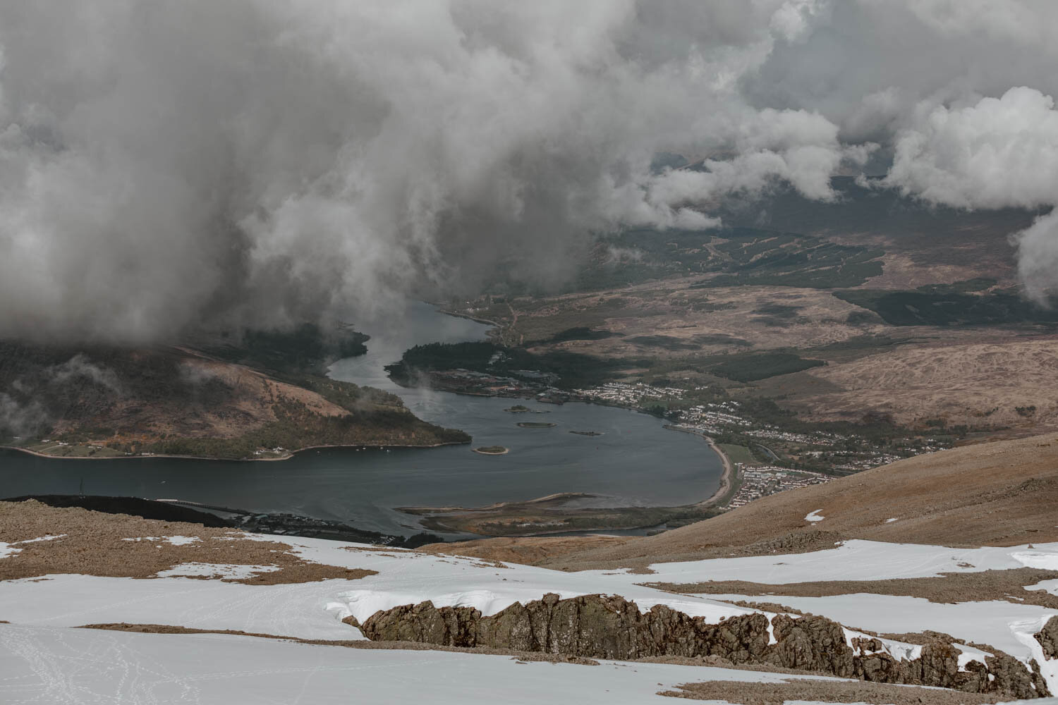
Further, the weather conditions here can change dramatically from hour to hour, day to day, and glen to glen. You may begin and end, as we did, with blue skies but as you scale the cloud cover shifts and thickens to obscure the trail, rain showers or gales may pass by, and then it all may disappear again before returning an hour later.
A cloud-covered summit (and top third generally) is not a rare thing at all here.
It is essential you check the specific weather and mountain forecast for Ben Nevis 48-72 hours in advance, so you can keep abreast of bad weather and plan (or change plans) accordingly. It isn't simply to find out the temperature at 900+ metres, but to understand the wind strength, the visibility, and the rainfall.
Those three factors will make or break your Ben Nevis experience.
Personally, we can't think of anything worse than 8 or 9 hours hiking in dreich Scottish weather with soggy feet, no views, no shelter, and the wind howling and swirling around me. The important point though is that walking Ben Nevis will not just be unenjoyable and unsafe if weather conditions are poor - it will be damn right foolish.
Mountain Rescue services in Scotland saw a record rise in callouts the last few summers, and the main factors were down to inexperience, lack of preparation, and not appreciating 'just how quickly conditions can turn”.
Please do not be one of them.
There are two websites we personally recommend you use to get this type of forecast in an accurate and easy to understand way:
Mountain Weather Information Services | Provides forecasts for 10 UK mountain areas 365 days a year. Forecasts are generally posted at 4:30pm for the next three days, with updates being made whenever necessary. The forecast for Ben Nevis is included within the West Highlands section here
Mountain Forecast | Less descriptive than the above, but contains all the necessary information to understand conditions. Find the Ben Nevis forecast here
Three Sensible Safety Steps
Tell someone that you’re going up Ben Nevis.
If really struggling or the weather is worsening dramatically, just turn around
Download the WhatThreeWords app to give your location quickly and easily to rescue services in the event of serious injury.
WHAT TO WEAR + PACK FOR BEN NEVIS
For spring & summer hikes in Scotland, you need to have comfortable clothing that will keep you dry and keep you warm. Always dress or pack expecting a shift in temperatures and rain to arrive.
If you are currently in the Highlands and don't have some essential clothing or kit with you, then you can find various outdoors shops in Fort William.
Wear /
Hiking boots or hiking trainers | These should be worn in properly before being used to hike Ben Nevis. If it's perfect summer conditions, you could get away with decent sports trainers but we don't recommend it.
Waterproof & Wind Resistant Jacket | We wouldn't go out for a hike in the Scottish Highlands without one of these in our daypack. Note that 'waterproof' is very different to 'water resistant'...and if it buckets down you'll quickly find that out (as we did a few years ago hiking in the Dolomites).
Hat & Gloves | As the temperatures decrease at the summit, it's always a good idea to have these in your bag. If very sunny, bright conditions are predicted, then a hat and sunglasses are necessary.
Warm Layers | Remember, It’s consistently at least 9 degrees cooler at the top of Ben Nevis than at the base.
Exactly how many layers you need, or what type, will depend on the conditions in which you're hiking Ben Nevis, what you have, and your own preferences.
For cold but clear days, we'd go for ethical merino wool (or synthetic) base layers for torso & legs, as well as another layer or two and a lightweight fleece. If it's not so cold, like when we hiked in May, then simply a t-shirt, thick shirts, and a fleece did the job with no base layers required.
Trousers | Going up in just your pants wouldn't be too fun, and the sheep may become concerned. If you prefer hiking in shorts, then we’d advise packing a pair of trousers too in case the chill becomes a little too much near the top.
Do you need hiking poles for Ben Nevis? After dismissing them for many, many years as something for older people and Austrians, we became converts to poles whilst doing the multi-day Inca Trail in Peru and Lost City Trek in Colombia. We don't use them for single-day hikes in the UK, and didn't on our Ben Nevis walk, but a significant number of people on the trail were using them.
They're really not just for people over a certain age.
Given the steep ascent, and never-ending descent, if you require the extra support or strength which hiking poles provide, then you absolutely should bring them. If you've got bad knees or are a little out of condition, then poles will also make things less hard on you across the 7-9 hours (our knees are pretty good and were feeling it by the end).
We own these travel hiking poles by Brasher.
Bring /
After the Visitor Centre and the Ben Nevis Inn, there ain't nothing on the trail or up at the top, so you need to bring everything with you. Pick it up, prep it, and pack it the night before to save you hassle or wasted time in the morning.
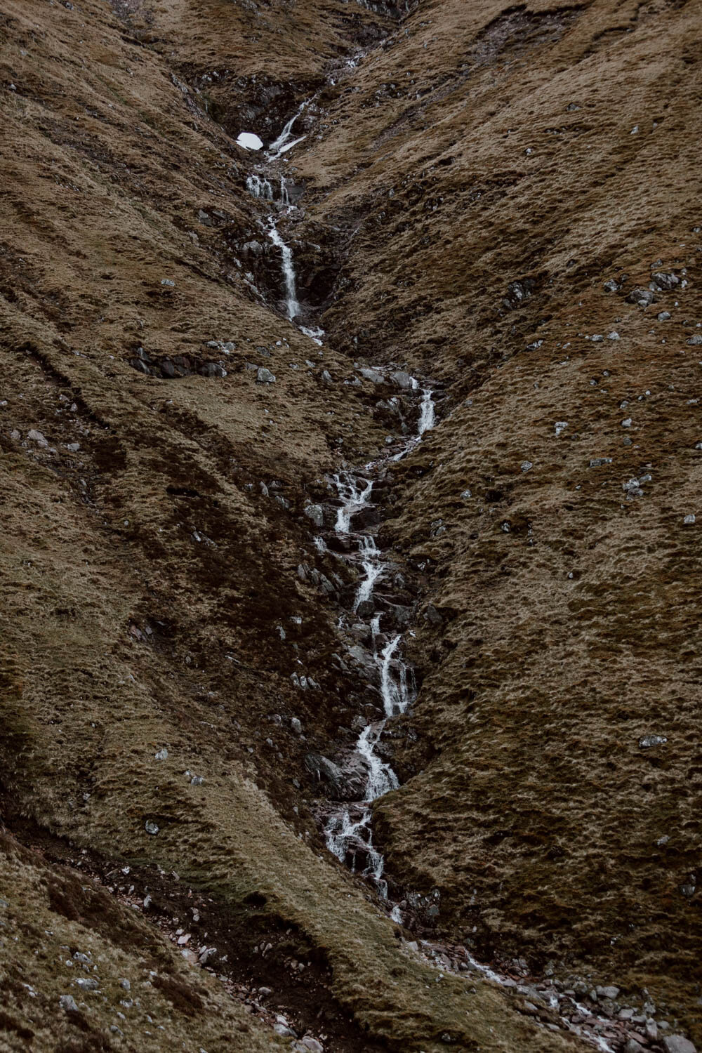
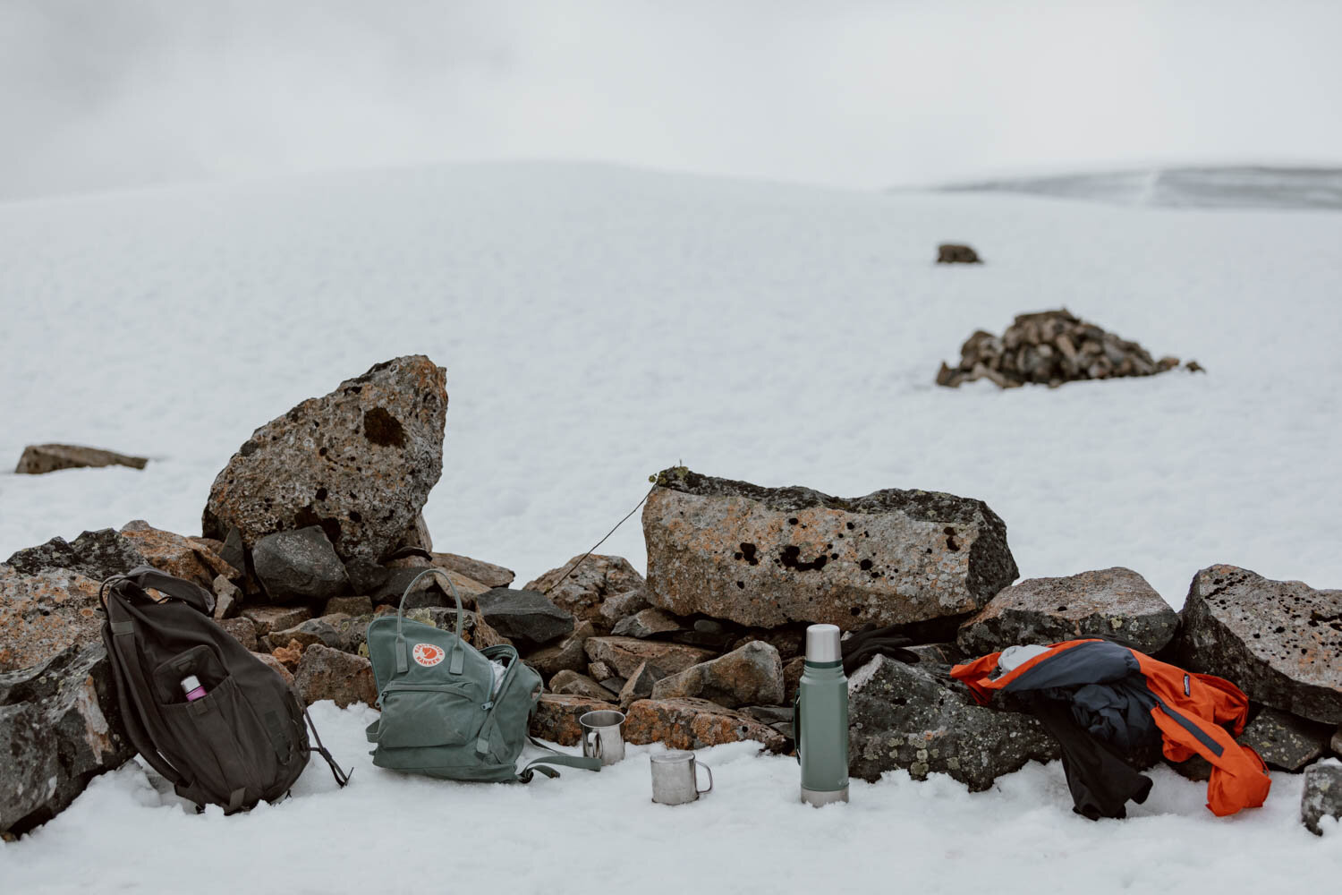
Water | Bring at least 2 litres with you, and then a can of Coke or Irn-Bru in case you need the little sugary pick you up. There's also the chance to fill up at a wee waterfall if you don't mind doing that - just don't underestimate the amount of water to take, especially if hiking in the sweatier summer months.
Packed Lunch | Hiking 7-9 hours is going to burn a lot of calories, so you need to bring at least one meal with you, possibly two if you are starting early and want breakfast on the way up. Sandwiches and crisps are always a winner with us, whilst Andrew adores this insulated Stanley food jar he bough last year for bringing soups or hot food with us on hikes.
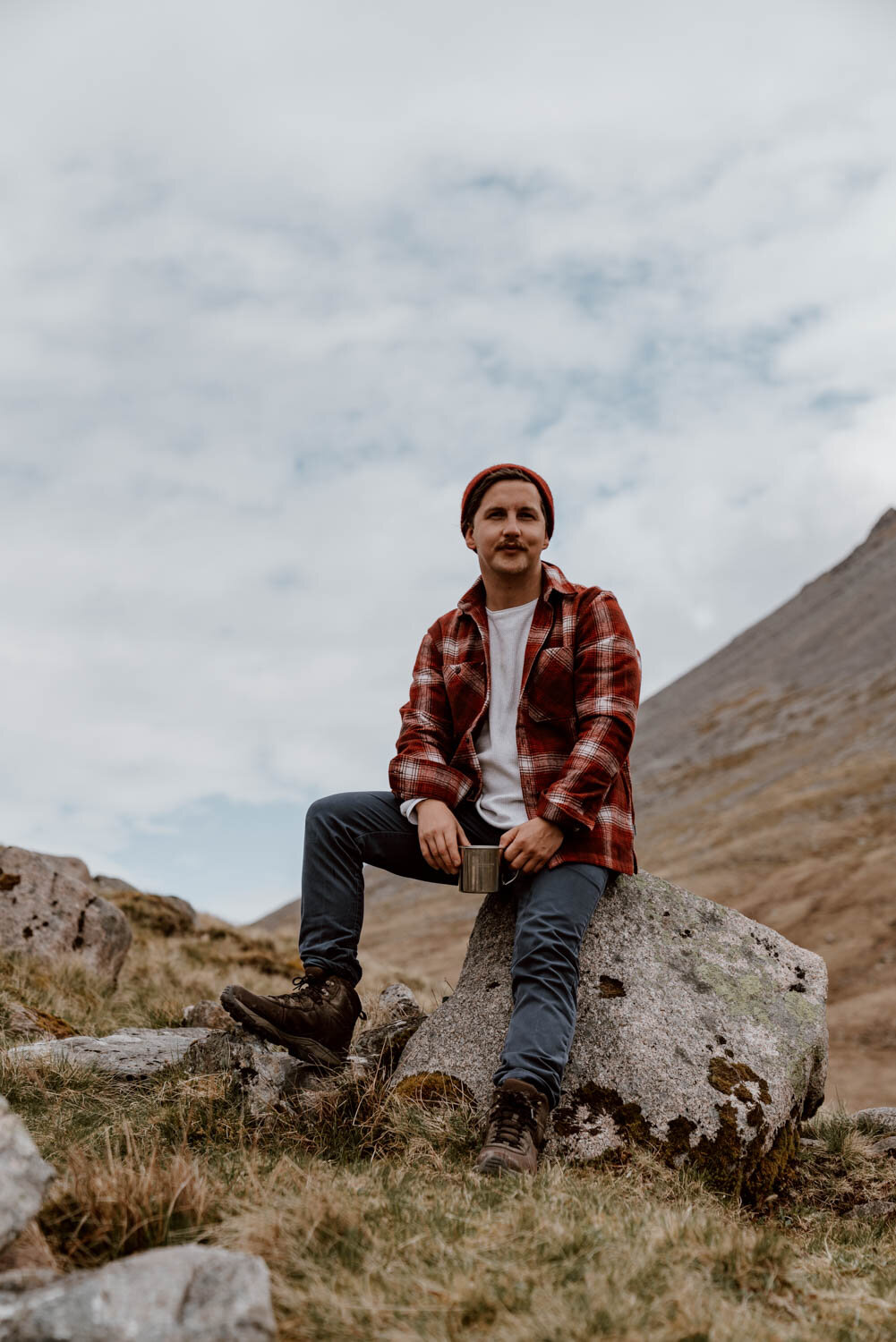
A Thermos | If you don't yet fully appreciate the joys of a wee cup of tea or coffee out in the hills, then you haven't lived. We know that makes us sound old and boring, but we actually only hike so that we can have cups of tea in the outdoors. We use and recommend this 1.4l Stanley Flask - it’s a bit on the dear side but cheap versions simply don’t last.
Snacks | Some sweeties, a trek bar, another sandwich or bag of crisps, maybe some fruit.
Suncream | Not essential for each and every Ben Nevis climb but, as exposure to UV increases by between 4 to 10 per cent every 1,000 ft above sea level you go, it’s important to slap this on and bring it with you - even if it’s an overcast day.
Mobile Phone | Set off with it fully charged in the morning, and bring a battery pack if you're going to be using it heavily for photos, videos, as well as navigations.
A rubbish bag | Please remember that it is your responsibility to take your litter back off the trail and dispose of it properly at the Visitor Centre or at the next bin you stop at. At the summit of Ben Nevis, we had to pick up an empty fag packet, chicken fajita sandwich wrapper, two empty crisp packets, and discarded orange peel, as well as four empty lager cans and two cans of red bull on the trail which people had left behind.
Arseholes.
If you can carry it in, you can carry it home - never leave it on the trail. Our tip is to always take a spare old plastic bag with you, or a bin liner, to keep everything in one place in your backpack.
Lastly, and we know we'll sound pedantic here, please do not leave banana skins or orange peel on the Ben Nevis trail (or any other walking trail). We lost count of the amount of peel we saw on the way up, and understand that people do this because it's viewed as 'natural' or 'biodegradable.
It may certainly be 'biodegradable' but it takes six months to two years for that process to occur - for the preceding 23.5 months, that non-native peel or fruit skin is just unnatural and unsightly litter on a beautiful Scottish landscape.
Paper or Downloaded Digital Map | Don’t go up Ben Nevis without a map of the route.
If you’ve got a paper or the OS map, that’s great (or you can buy one in Fort William). However, we know many of you will prefer using your phone as a guide. The most important thing is to not depend on having internet signal on this or any hiking trail, so you have to have an offline / downloaded version of your route map available on the phone too.
As mentioned above, we recommend doing this via the Maps.me or by downloading a Google Map, signing up to the pro version of AllTrails. You can also get a photo of the trail descriptions on the large noticeboard at the Ben Nevis Visitor Centre.
Respect | Lastly, it's essential that all of us on a trail respect the landscape, respect the wildlife there (including all the sheep you'll come across), and respect each other.
A wee nod and smile or a hello to the people you pass goes a long way. Similarly, a bit of patience and kindness if you're behind people who are a little slower than you could be the difference maker between encouraging someone to love the outdoors, or making them feel unwelcome.
Dogs should be kept 'under close control' but it's actually best to just keep them on a lead given the sheep roaming up here (and a number of lambs from March/April to September) and number of people on the trail.
For further advice on rights, rules, responsibilities, and respect, take a look at the Scottish Outdoor Access Code or read more tips for respectful hiking etiquette our Countryside Code post.
Climbing Ben Nevis | Preparation Checklist
1. Make sure you're in suitable condition to head out for a 7-9 hour hike.
2. Check weather forecasts on MWIS or Mountain Forecast.
3. Pack worn-in hiking boots or hiking trainers, a waterproof jacket, and warm layers.
4. Prep your bag with snacks, plenty water (especially in summer)
5. If you don't have a paper map, download the route map to your phone on Maps.me, Google Maps, or AllTrails, and make sure your phone is fully charged.
6. Let someone know your plans if your plans
7. Climb that goddam' mountain.
8. Leave no trace and take all your rubbish back with you.
9. Plan for Fort William with our guide - The Best Things To Do In Fort William.